


In order to build the Quabbin Reservoir, the Metropolitan District Water Supply Commission (MDWSC) acquired over 80,000 acres of land, which included 7,500 graves across thirty-four cemeteries. To accommodate these graves, the Commission hired Arthur Shurcliff to design a new cemetery to receive the disinterred bodies. Located outside the Quabbin watershed on former farmland and woodland but only three miles from the Administration Complex along Route 9, an important state road, the cemetery simultaneously separated itself from the MDWSC by blending into the existing landscape and remained close to its jurisdiction.
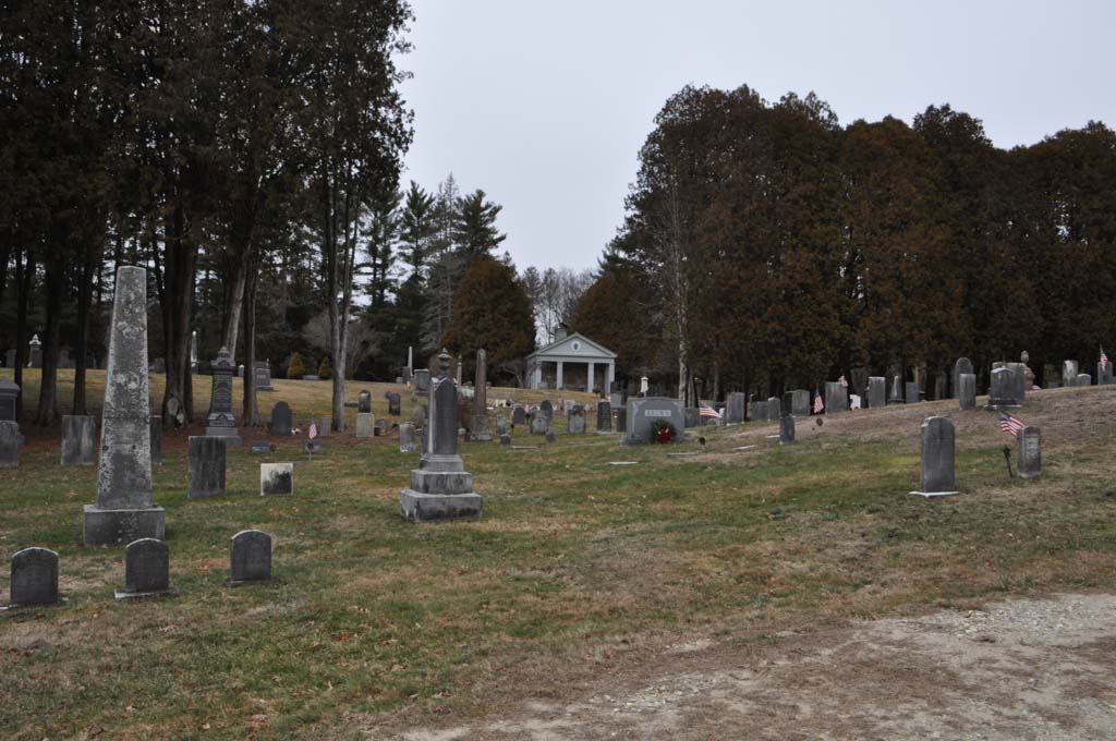
Shurcliff’s design, realized in 1932, included space for 11,290 plots, an area for the graves of unidentified remains, and a memorial area near its entrance replete with public war monuments relocated from the pre-existing cemeteries in the four affected towns. Two stone columns, constructed of pieces of the foundations of each of the churches in the flooded towns, signal the Quabbin Park Cemetery’s entrance. The 22-acre picturesque landscape beyond, not dissimilar from other rural cemeteries in the state, consists of a main curving drive with a few loops and a cul-de-sac that provides access to the individual graves, which were not grouped according to original cemetery, though families could elect to have their graves grouped. It was, however, a stark departure from the vernacular burial grounds it supplanted and again represents the imposition of order on the landscape by the state in place of the local vernacular traditions. The Commission began moving graves in 1932, completed the landscaping in 1938, and finished the reinternment project in 1944, two years before the Quabbin Reservoir had finished filling. In total it accepted the remains of 6,601 graves (of 7,613 dislocated by the reservoir). The Quabbin Park Cemetery remains active, with burial lots still available for former residents of the four flooded towns, their descendants, and former Department of Conservation and Recreation employees.
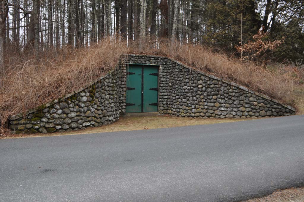
Two notable structures occupy the cemetery. A receiving vault with a capacity of eight bodies, completed in 1932, sits at the entrance to the cemetery. Built into an embankment, it is an earthen structure with a stone entrance wall (composed of stones taken from demolished houses) and heavy steel doors, evoking the design of the two major dams that created the Quabbin Reservoir. Thus, the functional structure sought to inject dignity into the otherwise undesirable process of moving and storing bodies. The Quabbin Park Cemetery Service Building is a single-story, rectangular structure in the Classical Revival style, made of dressed stone and featuring a gabled wood portico supported by Tuscan columns. It was designed by Cambridge, Massachusetts, architect Frederick Kingsbury, and follows the pattern of similar structures at other planned, rural cemeteries.
References
Bowers, M.H. “Form A – Area: Quabbin Reservoir, Belchertown, MA (BLC.G).” Boston: Massachusetts Historical Commission, May 1985.
Carolan, Jane. “Form F – Structure: Receiving Vault, Quabbin Park Cemetery, Ware, MA (WAR.910).” Boston: Massachusetts Historical Commission, , April 1985.
Carolan, Jane. “Form F – Structure: Service Building, Quabbin Park Cemetery, Ware, MA (WAR.227).” Boston: Massachusetts Historical Commission, April 1985.
Massachusetts Department of Conservation and Recreation. “Quabbin Park Cemetery.” Commonwealth of Massachusetts. Accessed May 29, 2019. http://www.mass.gov/.