


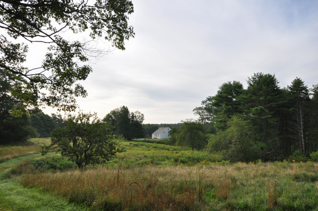

Pettengill Farm is a nineteenth-century saltwater farm located on an estuary of the Harraseeket River in Freeport. The thirty-foot-square saltbox house sits on over 180 acres of fields and woods that are bounded by the river to the south and west, Flying Point Road to the north, and Kelsey Brook to the east. As is typical of Maine saltwater farms, the fields gradually slope downward toward the marshland and saltwater rivers. Situated 600 feet back from the Harrakeeset River, the Pettengill house is perched atop a shelf of land about 60 feet above the level of the river. The farmland has been part of the Pettengill property since at least 1831.
The carefully chosen site, with the house facing south and the longer roof line sloping to the north, allows it to catch sunlight throughout the day in winter and be shaded by trees in summer. The farm outbuildings were arranged behind the house to create a courtyard that shielded the complex from winter winds. All that remains of the original courtyard is a toolshed and workshop. The saltbox farmhouse is the original structure; its rear lean-to was not built as an addition. The building has a center chimney, which is typical of saltbox houses from that era. The foundation is made of cut granite and a cellar walled in fieldstone extends the length of the house on the taller side.
The exterior of the house has been well preserved. Originally entirely made of clapboard, it is now covered with unpainted clapboards and shingles. The window casings are bounded by the clapboards. Above each of the front windows casings a board lays on its side three inches out from the house to help drain water from the structure. A narrow wooden cornice runs along the front of the house.
The side facade consists of one window on the left and two windows on the right, fairly close together. The doorway in the center of the symmetrical, four-bay house features a transom with four lights. There are four windows on the second floor arranged over the first floor openings. On the rear side of the first floor are three, unevenly arranged windows. On either side of the house are three windows directly above one another going up to the roof. A small eave window is located on the rear of the second floor. On the right side there is another window in the rear of the first floor with a door in the corresponding position on the left side.
Along the first floor at the rear of the house is the kitchen, with a pantry and back entry partitioned off to the left, and a stairwell on the right that leads to the second floor and to the basement. Two symmetrical front rooms are accessed from the kitchen by doors on either side of the kitchen fireplace; these rooms are also accessed from the small square hall behind the front door. On the second floor are two plastered walls that separate the small center front room from the rooms on either side of the chimney. Partitions in the left front room and the room under the eaves are not original. Sgraffitti adorn the walls of the three upstairs rooms; these etchings depict clipper ships and small boats as well as sea animals.
The interior of the house is very simply detailed and much of the woodwork is original. Four-panel doors have continuous narrow beading on the stiles and rails; other doors are board and batten. Moldings are used throughout the interior and repeat frequently. Each room in the house has chair rails that form the base of the window sill. In the kitchen there is a fireplace with a wooden mantel, and similar mantels are found in the front rooms. A door mounted in the fireplace surround of the right front room covers a brick baking oven. The hardware in the first floor front rooms is original, while the second floor has since been updated.
The house and farmland belonged to the Pettengills until 1970. The house is now home to the Freeport Historical Society, which operates it as a historic house museum. No longer in agricultural use, the property now contains public trails through its fields and woods.
References
Wengren, Mary-Eliza, “Pettengill House and Farm,” Cumberland County, Maine. National Register of Historic Places Inventory–Nomination Form, 1972. National Park Service, U.S. Department of the Interior, Washington, DC.