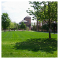
In 1947, in anticipation of increased enrollment following World War II and the resultant strains on the Central Campus ( WA7) and Ann Arbor itself, the University of Michigan regents bought 267 acres north of the Huron River for future campus expansion; the campus now covers 800 acres. In 1951 the regents commissioned Eero Saarinen (1910–1961) to design a master plan to connect the rolling countryside site into a satellite campus and to create a flexible plan that would allow for future construction and expansion. Reflecting the ideals of Cranbrook ( OK4), Saarinen's plan emphasized cohesion with buildings connected by pedestrian plazas and highlighted by a square central plaza descending in five terraced planes to a deeply set fountain. A boulevard and street network would link downtown Ann Arbor and the main campus to this suburban campus.
Saarinen's master plan was not realized. North Campus seemed a distant suburban campus surrounded by busy roads and without nearby stores and restaurants. Saarinen blamed the difficulties at North Campus on randomly selected architects, administrators, lack of coordination in planning and design, and insufficient funding that prevented the proper development. Subsequently, Johnson, Johnson and Roy (JJR) and, in 1998, Venturi, Scott Brown and Associates (VSBA) worked on university master planning. VSBA noted the difficulty of integrating two campuses separated by two miles, the social isolation of North Campus, and its lack of commercial businesses. In 2008 an updated master plan, by Sasaki Associates, calls for “making North Campus a more vibrant and livable space that is richer socially, easier to get to, and more convenient to get around.” The plan will direct development that encourages “vitality, collegiality and a sense of place.” Today Lurie Tower ( WA11.2) defines North Campus.


