You are here

David Thompson State Historic Site

-A A +A
1925 established. 49th St. N, 0.5 miles west of 7th Ave N
  • (Courtesy of the State Historical Society of North Dakota)

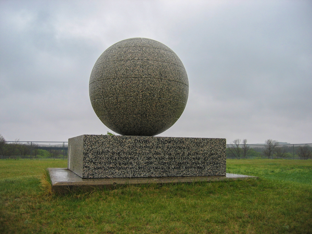
The land and monument for this site were donated by the Great Northern Railway to honor explorer and geographer David Thompson, who passed this spot in 1797 and 1798 while on a scientific and trading expedition for the Northwest Company, a Hudson’s Bay Company competitor. Thompson made the first reliable map of the region between what is now North Dakota and Lake Superior. His early knowledge of the people and landscapes was so precisely reliable that Lewis and Clark reportedly used a Thompson map on their 1804–1806 expedition. The monument consists of a granite globe on a rectangular granite base.

Writing Credits

Author: 
Steve C. Martens and Ronald H. L. M. Ramsay
×

Data

What's Nearby

Citation

Steve C. Martens and Ronald H. L. M. Ramsay, "David Thompson State Historic Site", [Karlsruhe, North Dakota], SAH Archipedia, eds. Gabrielle Esperdy and Karen Kingsley, Charlottesville: UVaP, 2012—, http://sah-archipedia.org/buildings/ND-01-MH7.

Print Source

Cover: Buildings of North Dakota

Buildings of North Dakota, Steve C. Martens and Ronald H. L. M. Ramsay. Charlottesville: University of Virginia Press, 2015, 125-125.

If SAH Archipedia has been useful to you, please consider supporting it.

SAH Archipedia tells the story of the United States through its buildings, landscapes, and cities. This freely available resource empowers the public with authoritative knowledge that deepens their understanding and appreciation of the built environment. But the Society of Architectural Historians, which created SAH Archipedia with University of Virginia Press, needs your support to maintain the high-caliber research, writing, photography, cartography, editing, design, and programming that make SAH Archipedia a trusted online resource available to all who value the history of place, heritage tourism, and learning.

,