

Huning’s Highlands Addition; Huning Highlands Historic District
You are here
Huning Highlands Addition


1880 and later. Bounded by Broadway SW, Martin Luther King Blvd. SW/SE, Locust St. SE, and Coal Ave. SE/SW.


The Huning Highlands Addition was Albuquerque’s first residential subdivision and it prefigured the city’s history of decentralized urban development.
The subdivision was a product of the same financial interests and speculative planning that created New Town Albuquerque. It is named after Franz Huning, a prominent local businessman who, in partnership with Elias Stover and William Hazeldine, had formed the New Town Company as a subsidiary of the Atchison, Topeka and Santa Fe Railroad (AT&SF) in March 1880. That same month, Stover bought a tract of upward sloping land east of the projected New Town and railroad tracks for $200 from Melquiades and Anna Chavez. The following June, he sold this land for the same amount to Huning. In partnership with Thomas Phelan, Huning developed the parcel as the core of Albuquerque’s first residential subdivision (and simultaneously built himself an adobe-and-sod mansion called Huning Castle between Old Town and New Town, demolished in 1957).
Platted by Walter G. Marmon, the civil engineer who planned New Town, the Huning Highlands Addition was laid out on a grid of north-south and east-west streets that ran to either side of Railroad Avenue. Originally, it was bordered by the AT&SF property line to the west, Tijeras Avenue to the north, High Street to the east, and Iron Avenue to the south. Subsequent plats both adjusted and expanded the suburb to its currently recognized boundaries; the 1885 plat laid out 536 rectangular lots, most of them 50 by 141 feet.
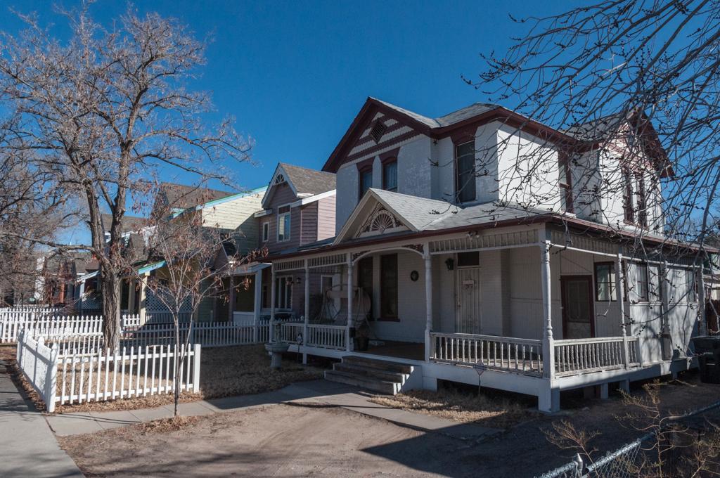
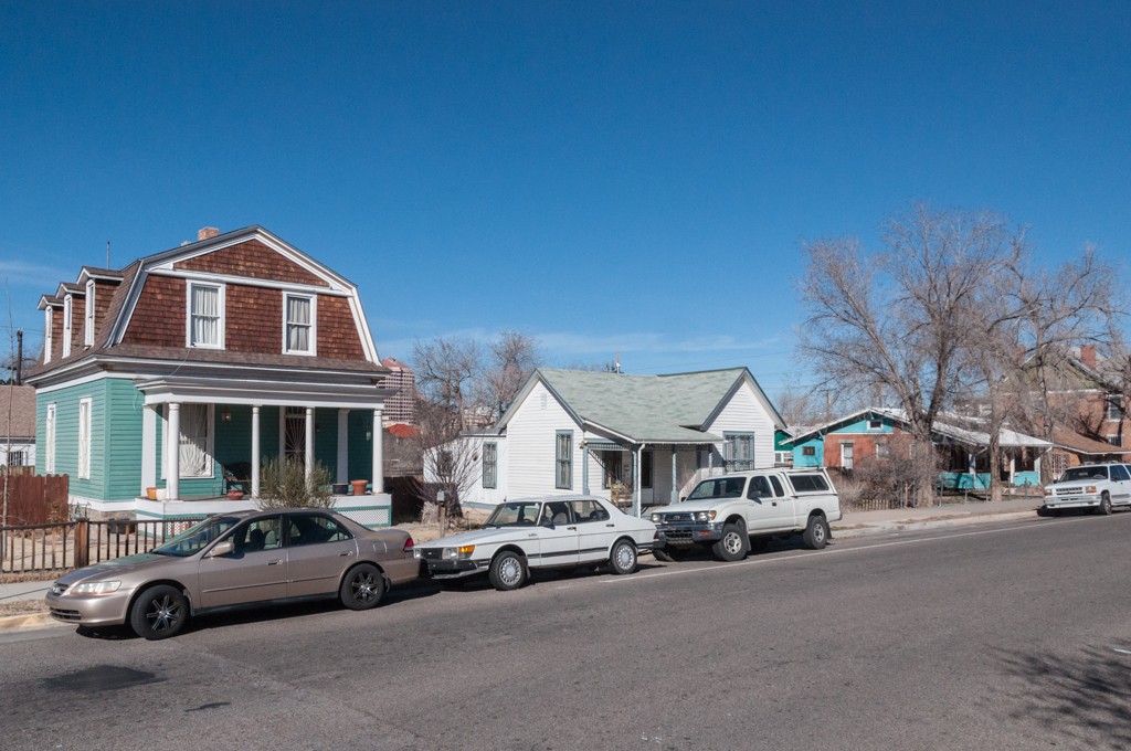
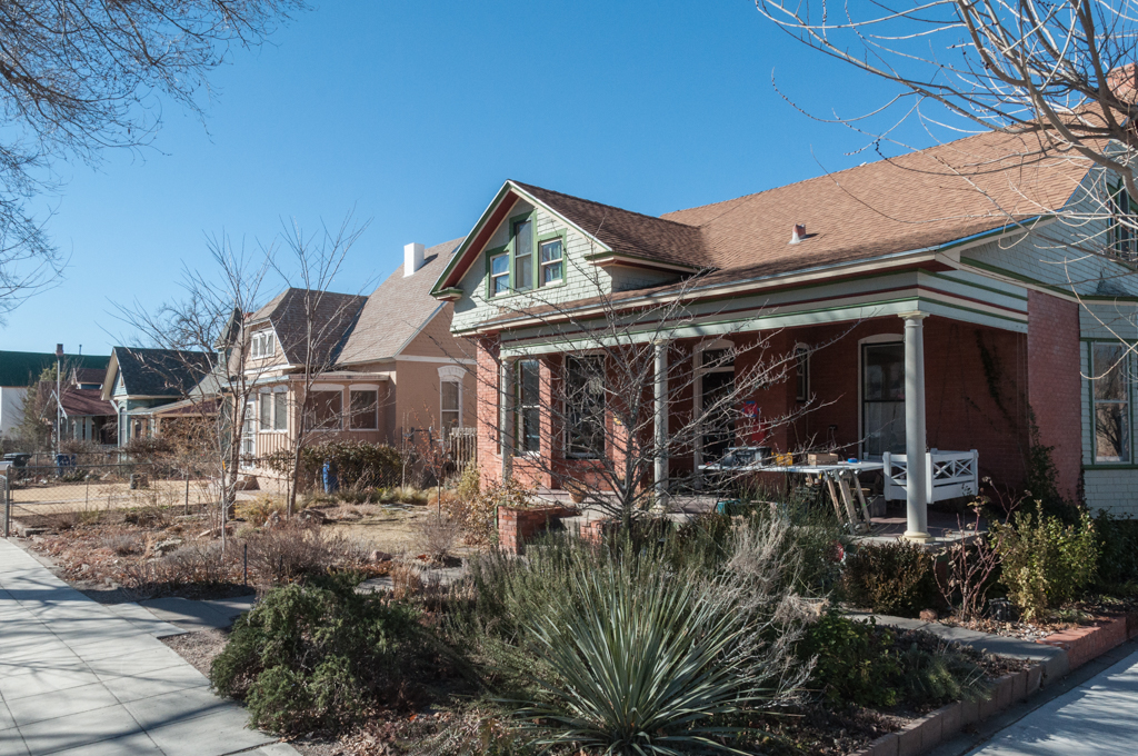
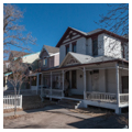
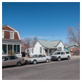
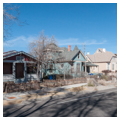
The wood frame or brick houses were built for Anglo newcomers who worked in New Town as railroad employees, merchants, and professionals. Their builders, mostly contractors and carpenters, followed patterns and styles imported from the Midwest and East Coast. Set in from the street between front and back yards, with front porches and pitched roofs, the earlier houses were typically realized in hybrid variations of Gothic, Italianate, and Queen Anne styles; later ones introduced simplified versions of the California Mission, Dutch Colonial, Bungalow, and Prairie styles.
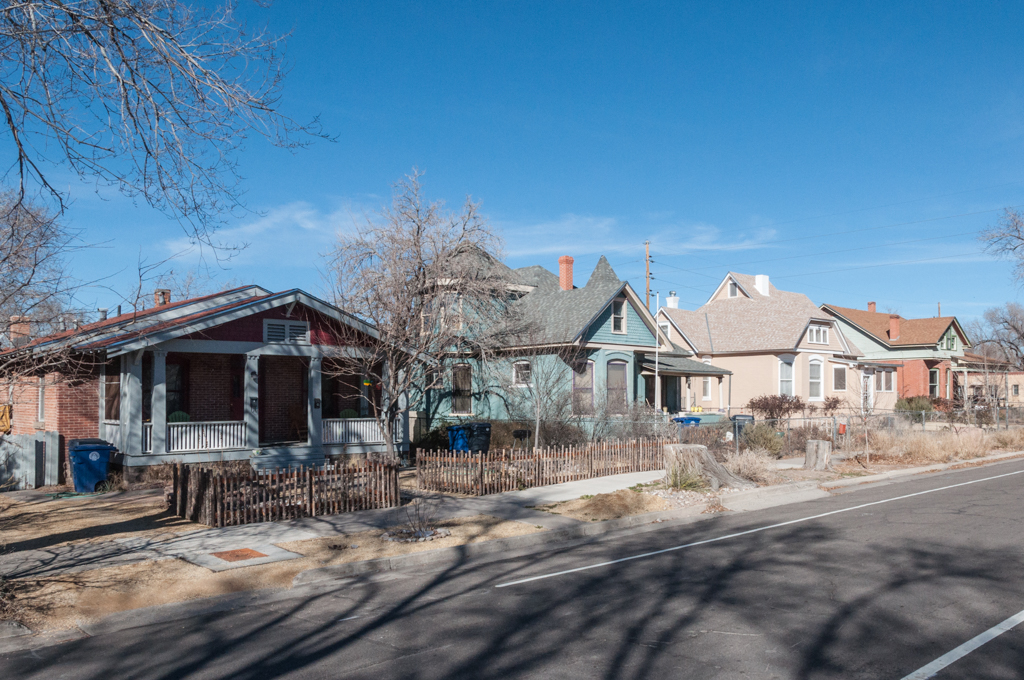
By the time the addition had filled up in 1925, it was already beginning to decline as residents moved to newer suburbs on the East Mesa. Houses were converted to rentals and apartments, and the neighborhood was fragmented by the increasingly busy thoroughfares of Central, Lead, and Coal Avenues, and by commercial construction (especially along Central Avenue and Broadway). Paradoxically, much of its historical fabric was preserved by the benign neglect of slum landlords. Represented since the 1970s by an active neighborhood association, the Huning Highlands district was listed on the National Register of Historic Places in 1978. Its ongoing gentrification has been the subject of two municipal sector development plans (1977 and 1987) aimed at encouraging the district’s residential and commercial viability.
References
DeWitt, Susan. Historic Albuquerque Today: An Overview Survey of Historic Buildings and Districts. 2nd edition. Albuquerque, NM: Historic Landmarks Survey of Albuquerque, 1978.
Gunning, Donald, “Huning Highlands Historic District,” Bernalillo County, New Mexico. National Register of Historic Places Inventory–Nomination Form, 1977. National Park Service, U.S. Department of the Interior, Washington, D.C.
City of Albuquerque. Huning Highland Sector Development Plan. Albuquerque, NM: City of Albuquerque Planning Department, 1988.
Simmons, Marc. Albuquerque: A Narrative History. Albuquerque: University of New Mexico Press, 1982.
Writing Credits
Coordinator:
Christopher C. Mead
Regina N. Emmer
If SAH Archipedia has been useful to you, please consider supporting it.
SAH Archipedia tells the story of the United States through its buildings, landscapes, and cities. This freely available resource empowers the public with authoritative knowledge that deepens their understanding and appreciation of the built environment. But the Society of Architectural Historians, which created SAH Archipedia with University of Virginia Press, needs your support to maintain the high-caliber research, writing, photography, cartography, editing, design, and programming that make SAH Archipedia a trusted online resource available to all who value the history of place, heritage tourism, and learning.