


One of the oldest communities in Albuquerque, Barelas was successively a colonial settlement in the seventeenth century, an agricultural village in the eighteenth century, a working-class neighborhood transformed by the railroad in the nineteenth century, and a thriving commercial strip associated with the automobile in the twentieth century. More recently recognized as a center of Hispanic culture, Barelas’s identity has gone through multiple phases and is as complex as the economic changes that have shaped its history.
Present Barelas is a triangular neighborhood bound by the former Atchison, Topeka and Santa Fe (AT&SF) locomotive shops to the east, Coal Avenue to the north, and the Rio Grande to the west. It is located within a wooded floodplain known as the bosque grande, or great wood, that stretches some forty miles along the Rio Grande. The area known as El Estero de Mejía (the estuary of Mejía) was first settled in 1662 by Pedro Varela, who built an estancia or ranch there and for whom the community was later named. After the Pueblo Revolt of 1680–1692 forced the Spaniards out of New Mexico, Barelas was abandoned until 1707, when Antonio Barela returned and successfully petitioned for ownership of the lands that had belonged to his family before 1680.
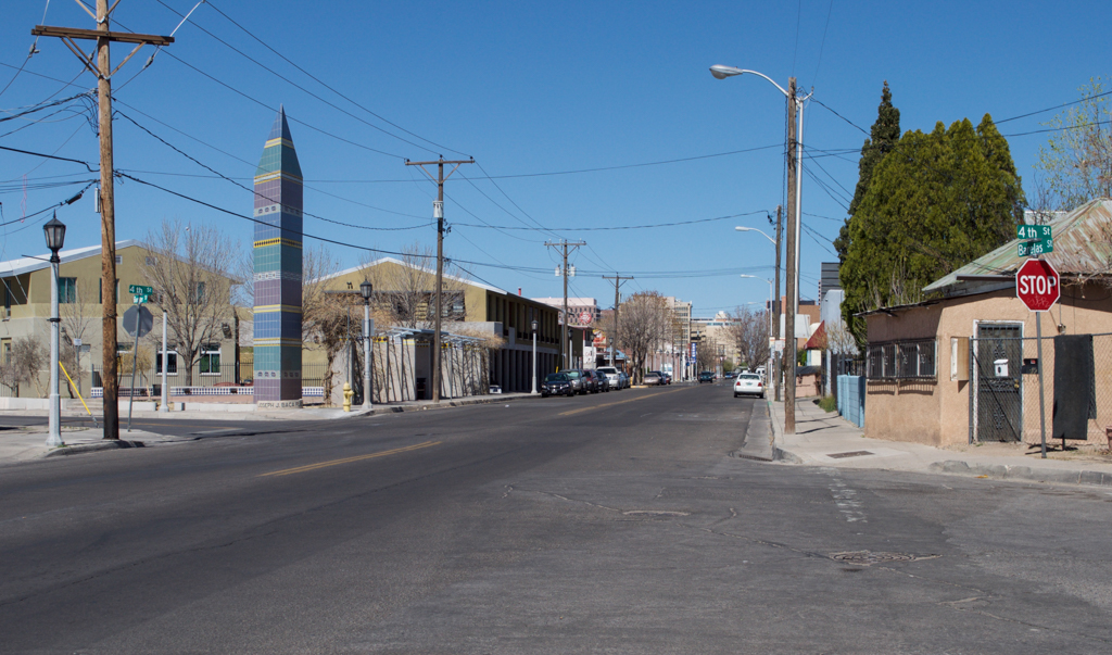
Positioned at a natural ford across the Rio Grande, Barelas thrived both as an agricultural community and as a trading post on the Camino Real de Tierra Adentro, the royal highway of the inner land connecting Mexico City to Santa Fe. In 1830, Antonio Sandoval built the Acequia Madre de los Barelas, the community’s main irrigation ditch that diverted water from the Rio Grande. Farming families moved here from the separate settlement of Albuquerque a mile away to the northwest and built one-story vernacular adobe residences along the Acequia Madre and what became known as Barelas Road (modern Fourth Street).
The arrival of the AT&SF in Albuquerque in 1880 turned Barelas from an agricultural village into the working-class neighborhood of a modern industrial city. New Town Albuquerque was developed immediately to the north of Barelas, while the AT&SF built its sprawling complex of locomotive repair shops to the east, alongside the railroad tracks and First Street. The residents of Barelas went to work for the railroad, first laying tracks and then repairing locomotives. By 1891, the neighborhood had been absorbed into New Town Albuquerque. By 1900, its population had grown to 1,200 as workers migrated from Tomé, Valencia, Chihuahua, Mora, Juárez, Zacatecas and other places in Mexico, forming a diverse Hispanic community that shared a common identity as “Bareleños.”
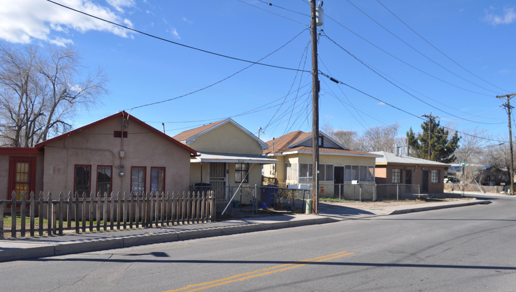
The community’s agricultural lands to the east, now partly cut off from Barelas and the Acequia Madre by the railroad tracks, were sold for residential subdivisions. Many of the flat-roofed adobe houses built along Barelas Road in the nineteenth century were either altered by the addition of gable roofs or replaced by Queen Anne and Bungalow style houses built of wood or brick, with pitched roofs. Examples like the Garcia-Lopez House were working class counterparts to the middle-class houses going up at the same time in the Huning Highlands Addition west of the railroad tracks, and they similarly were products of the new building materials and patterns being brought by the railroad from the eastern United States.
In the twentieth century, the automobile joined the railroad as an engine of economic development for Barelas. In 1912, New Mexico began planning and grading two highways that bisected the state north to south and east to west. Crossing Albuquerque along Central Avenue and Fourth Street, these were integrated into a national system of highways in 1926, when they became Route 85 between Denver and El Paso and Route 66 between Chicago and Los Angeles; until Route 66 was completed through New Mexico in 1937, it joined Route 85 from Santa Fe to Albuquerque. As a result, both national highways initially ran right through Barelas along Fourth Street, from which Route 66 then headed west again across the Rio Grande over the Barelas Bridge, Albuquerque’s only permanent, steel bridge (built in 1910). By 1928, some 3,500 automobiles were crossing the Barelas Bridge every day.
As Fourth Street became one of Albuquerque’s main commercial thoroughfares, shops, restaurants, cafes, service stations, car dealerships, and a tourist court were built in variously Mission, Streamlined Moderne, and International Style idioms. Extant examples include the Magnolia Service Station, the Durand Motor Company, and Mikes’ Food Store. At its height from the 1930s to the 1950s, the economic opportunities offered by the traffic on Route 85 also led some residents to build commercial additions in front of their houses, as can be seen with both the Red Ball Café and the Martin Peña Barbershop.
Barelas thrived until 1956, when its fortunes began to change in two ways. First, the AT&SF switched from steam-powered locomotives to diesel engines, which required much less maintenance and justified cutting the local workforce from over 1,000 to fewer than 100 employees. Second, Congress passed the Interstate Highway Act that same year, creating a new freeway system that would replace Routes 85 and 66 and consequently bypass Fourth Street and Barelas. Yet the Tasty Freeze Drive-In, built in the late 1950s, indicates that the economic effects on Barelas were gradual rather than immediate as local businesses continued to prosper.
Slowly, however, businesses along Fourth Street began to close. Both houses and commercial buildings were abandoned as about one-third of the neighborhood’s residents relocated to elsewhere in Albuquerque. Because Barelas increasingly lacked the financial resources to support a police force, fire safety, street lighting, and water and sewage systems, the remaining residents voted in 1964 to be formally annexed by the City of Albuquerque, in return for municipal services and utilities.
Funded by an Urban Development Grant, the city launched a program of urban renewal in the 1960s and 1970s. Adobe houses in South Barelas were demolished and their residents were relocated to new, wood-framed houses in North Barelas. These efforts failed to have their intended effect, however, and the neighborhood developed a reputation as an urban slum characterized by drug abuse, violence, poverty, vandalism, and crime.
The establishment of the Hispanic Culture Foundation in 1983 led to the decision in 1993 to erect the New Mexico Hispanic Cultural Center in South Barelas, and marked a turning point for the community. Private investment, merchants’ associations, and Main Street restoration projects worked to revive Fourth Street, including the Red Ball Café, which reopened in 1998. In 2001, the New Mexico Hispano Chamber of Commerce moved to Barelas, erecting its new offices on Fourth Street. In 2008, an updated Sector Development Plan identified Barelas as a cultural resource with a long history, designated new zoning and land use guidelines, and proposed a series of community development initiatives. Ongoing plans to rehabilitate the AT&SF locomotive shops through adaptive reuse promise new jobs and income for the community.
The community’s identity continues to evolve as some residents fear ongoing gentrification will push out long-time residents, while others support the efforts to attract tourism and spur renewed economic growth.
References
Barelas Community Project Records, Center for Southwest Research, University Libraries, University of New Mexico.
City of Albuquerque. Barelas Sector Development Plan. April 2008. Accessed January 19, 2016. https://www.cabq.gov.
Emma Moya Collection on the History of Old Town Albuquerque and Related Communities, Center for Southwest Research, University Libraries, University of New Mexico.
National Hispanic Cultural Center. Barelas a Través de los Años. Albuquerque, NM: National Hispanic Cultural Center, 2010.
Sánchez, Joseph P., and Larry D. Miller. Martineztown 1823-1950: Hispanics, Italians, Jesuits & Land Investors in New Town Albuquerque. Los Ranchos de Albuquerque, NM: Rio Grande Books, 2009.
Webb, Andrew. “Red Ball Cafe Shut Down as Barelas Decayed but Returned Amid Revitalization Efforts.” Albuquerque Journal, December 10, 2005.
Wilson, Chris, “Auto-Oriented Commercial Development in Albuquerque, New Mexico, 1916-1956,” Bernalillo County, New Mexico. National Register of Historic Places Inventory–Nomination Form, 1996. National Park Service, U.S. Department of the Interior, Washington, D.C.
Wilson, Chris, “Barelas-South Fourth Street Historic District,” Bernalillo County, New Mexico. National Register of Historic Places Inventory–Nomination Form, 1996. National Park Service, U.S. Department of the Interior, Washington, D.C.