

-
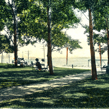 Riverside Park, c. 1908-1911 (Buffalo Olmsted Parks Postcards & Stereo Views. Courtesy of Buffalo Olmsted Parks Conservancy)

Olmsted and Vaux’s successor firm designed Riverside Park as the last of the Buffalo park and parkway system. The 22-acre parcel is the northernmost park in the system, and the only to offer waterfront access. It is situated on the eastern banks of the Niagara River, just north of a cemetery abutting Niagara Street and Esser Avenue. The river is accessed via a footbridge across the Erie Canal and a boat landing on the river—both preexisting features.
The Olmsted Brothers designed Riverside Park as two distinct and opposing zones: a formal landscape aligned with the footbridge, which featured a large circular fountain and a circular music court, and a naturalistic landscape consisting of an open green (delineated as a ball field), thick copses pierced by meandering footpaths, and a linear series of serpentine minnow pools. The two spheres were separated by a gently curving carriage drive, while the trapezoidal parcel’s street frontages were screened with either a single row of trees or an allée. The drive fed into Niagara Street on the west and Roesch Avenue on the east, which was conceived as part of the parkway system, intended to connect Riverside Park with The Park, but which was never completed.
The park was nearly doubled in 1912 when the Board of Park Commissioners acquired an additional 17-acre, L-shaped parcel on its southern boundary. The addition, however, was never fully designed since the board was disbanded three years later. With the abandonment of the Erie Canal circa 1918, the park subsumed additional riverfront acreage, but this was lost (along with the park’s footbridge and boat landing access) with the construction of the Niagara Thruway between 1953 and 1964, which has severed Riverside Park’s connection to the river.
Like many of Buffalo’s historic parks, Riverside deteriorated from neglect and intrusions through the bulk of the twentieth century. The formal court was eradicated with the construction of a senior citizens’ center, a covered ice-skating rink, and a large swimming pool. The original ball field has been transformed into athletic fields, while the southern addition (hardly integrated into the original parkland and accessed primarily from perimeter streets) has been dedicated to active recreation in the form of a wading pool and bathhouse, four baseball diamonds, one softball pitch, and four tennis courts. The minnow pools were infilled and the groves have thinned over the years. The Y-shaped carriage drive was reduced to one branch, renamed Hotaling Drive, which was widened at the Roesch Avenue entrance for parking. Furthermore, the incompletion of Roesch Avenue as a leg of the parkway system has resulted in Riverside’s isolation from the other Olmsted parks.
Masterplans to restore Riverside Park were developed in 1994 and 2008, and called for improved connection to the waterfront and significant tree planting. As a result, the irregular outlines of the minnow pools were recreated as depressed landscaped lawns (the 2008 document calls for their complete restoration in the future). Unrealized objectives from the masterplans include the removal of the surface parking on Hotaling Drive; the restoration of the drive’s cobblestone curbs; the relocation of the senior center and pool to areas outside the park; and the construction of a performing arts stage on the site of the original music court.
References
Broderick, Stanton M. “Buffalo’s Olmsted Parks and Parkways System.” Olmsted in Buffalo. Accessed March 16, 2021. https://www.olmstedinbuffalo.com/.
Kowsky, Francis R., ed. The Best Planned City: The Olmsted Legacy in Buffalo. Buffalo: Burchfield Art Center, 1992.
Kowsky, Francis R. “Municipal Parks and City Planning: Frederic Law Olmsted’s Buffalo Park and Parkway System.” Journal of the Society of Architectural Historians 46 (March 1987): 49-64.
Rogers, Elizabeth Barlow. Landscape Design: A Cultural and Architectural History. Harry N. Abrams, Inc., 2001.
Ross, Claire L., “Olmsted Parks and Parkways Thematic Resources,” Erie County, New York. National Register of Historic Places Registration Form, 1982. National Park Service, U.S. Department of the Interior, Washington, D.C.