


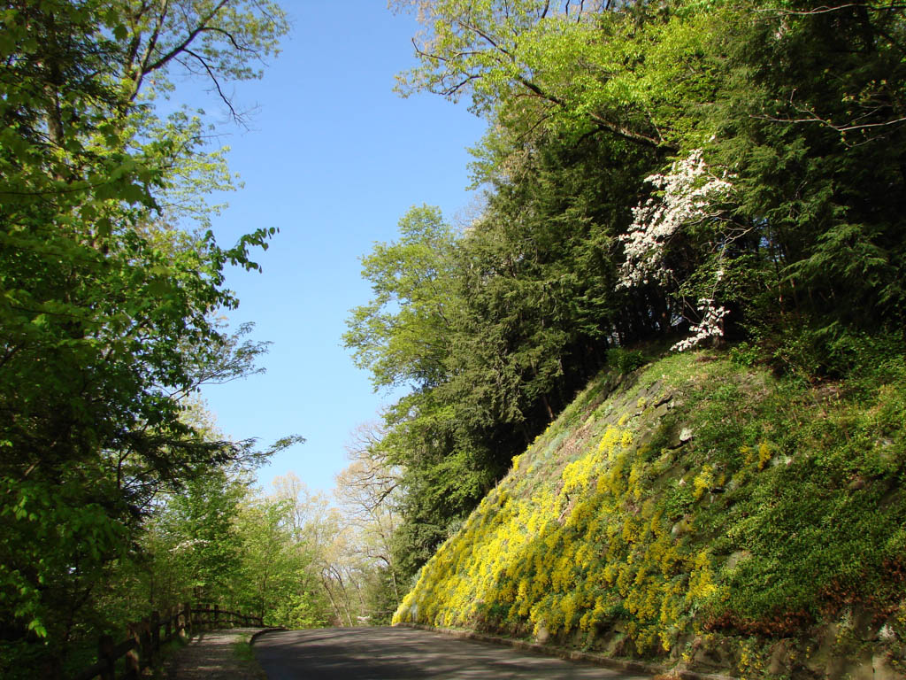
Founded in 1891, Mill Creek Park encompasses 1,562 acres in Youngstown and Boardman, with three lakes, two eighteen-hole golf courses, thirteen-and-one-half miles of trails, drives on both sides of Mill Creek, six picnic shelters, two recreation areas, and a twelve-acre public garden. The park, which is notable for its landscape design and its recreational planning, is the result of sequential work by landscape architects H.W.S. Cleveland, Charles Eliot, Warren H. Manning, Hugh Imlay, Olmsted Brothers, John Paolano, and golf course architect Donald Ross. Its architecture and its bridge and dam engineering are equally significant, with the latter reflecting Youngstown’s role as a national center for the iron and steel industries in the late nineteenth and first half of the twentieth centuries.
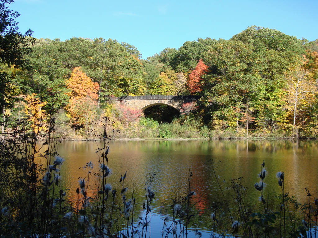
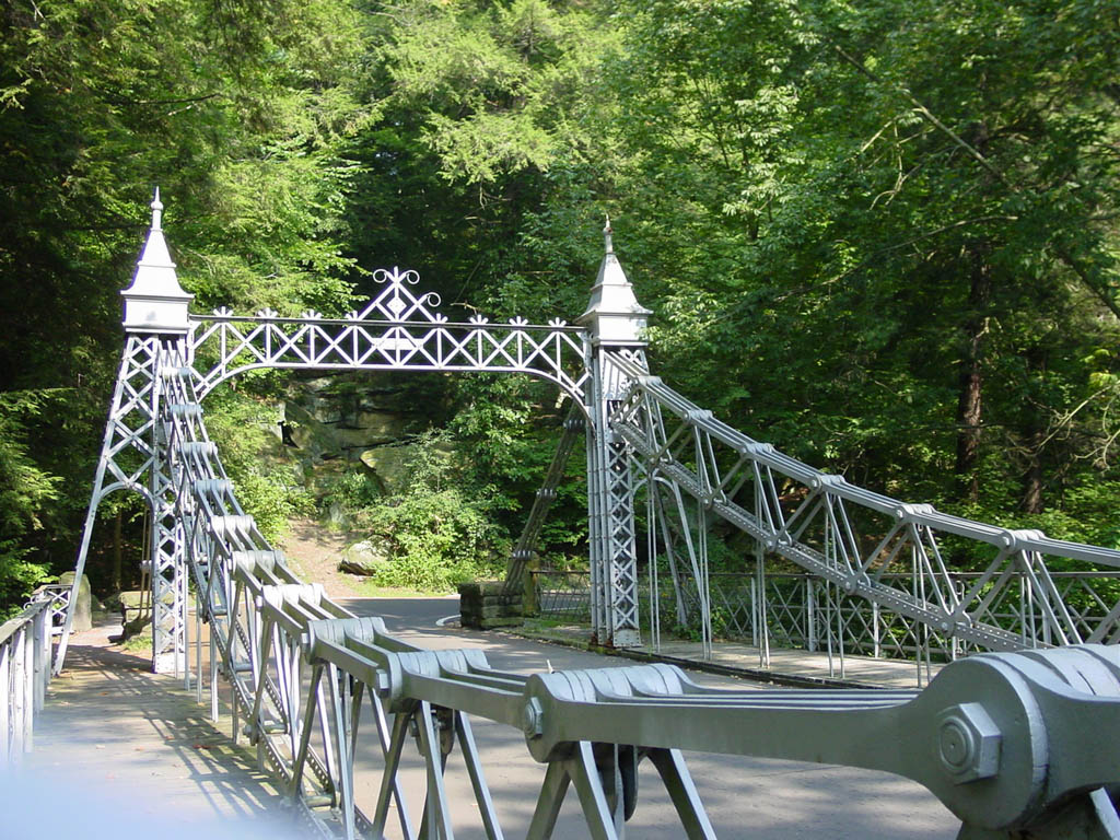
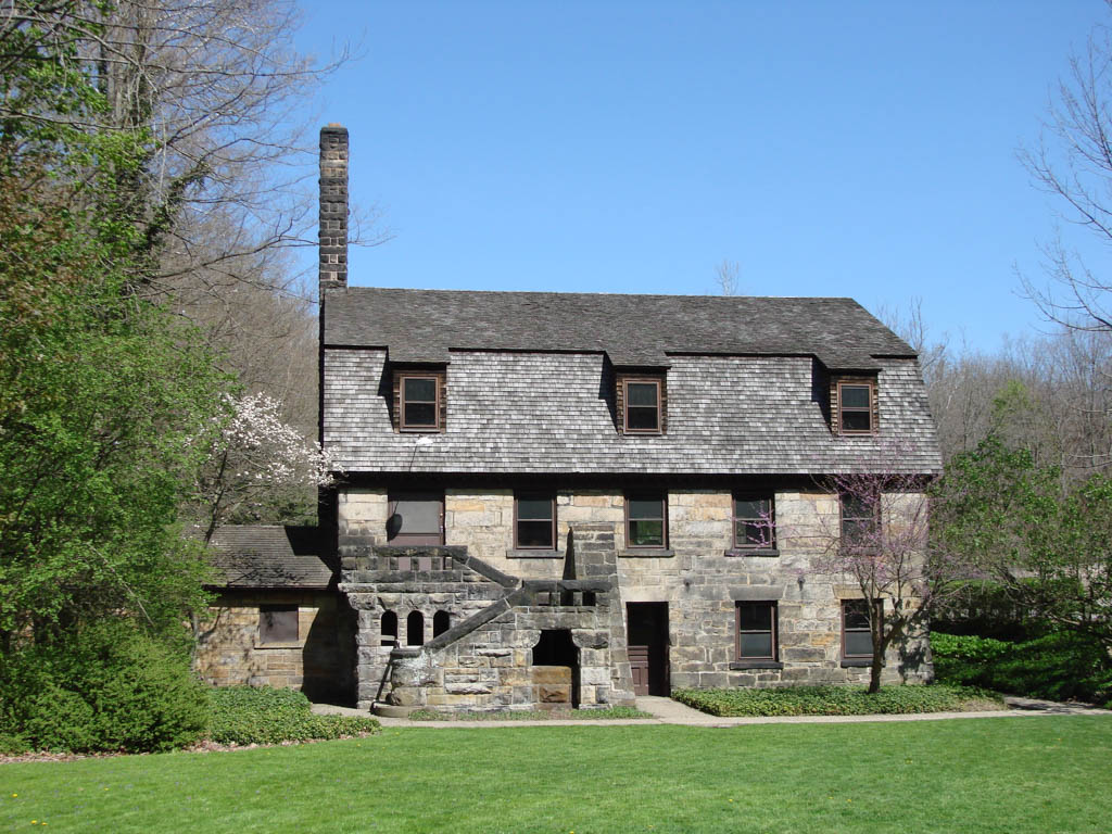
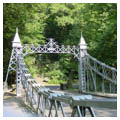
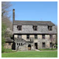
In 1891 Youngstown lawyer Volney Rogers wrote park-enabling legislation that the Ohio legislature passed as the Township Parks Improvement Act. On April 6, 1891, Youngstown Township residents voted to establish the first township park in Ohio along the steep hemlock gorge of Mahoning River tributary, Mill Creek. Between 1891 and 1918, the three park commissioners hired landscape architects H.W.S. Cleveland of Minneapolis and Charles Eliot of Boston to lay out drives and trails along the most dramatic natural elements of the 440-acre gorge. The Youngstown Bridge Company designed five iron bridges (one survives), while local masons constructed three sandstone bridges. Shepley, Rutan and Coolidge of Boston supplied designs for two more sandstone bridges (1904 and 1912). The dramatic 1913 Parapet Bridge, a sandstone-faced concrete arch, is the work of Julius Schweinfurth. In an early example of repurposing an industrial building, Youngstown architect William Ellis converted an abandoned early-nineteenth-century sandstone fulling mill into Pioneer Pavilion (1893) with a timber-trussed gambrel roof. Schweinfurth added the Craftsman Slippery Rock Pavilion (1910) with massive sandstone piers and red terra-cotta tile roof.
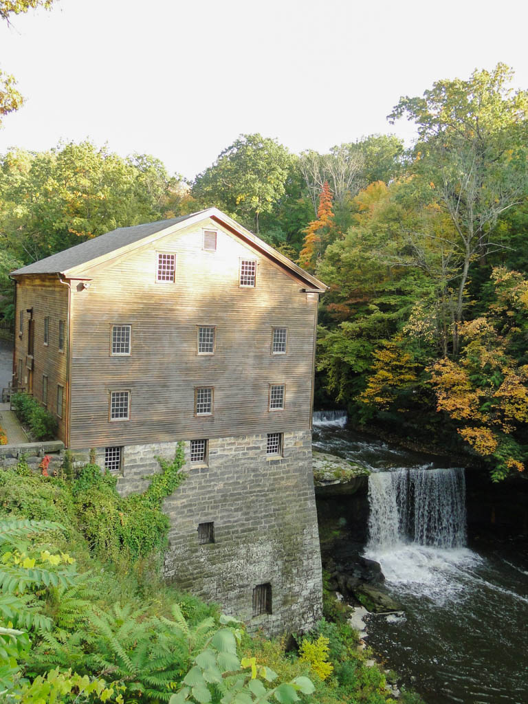
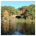
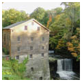
Working from 1920 until 1932, Warren H. Manning led landscape design alongside landscape architect Hugh Imlay, then serving as park superintendent, and park and county engineers. Together, the team expanded the completed section of the park with a park office and a large recreation area on the east side, above the hemlock gorge, with tennis courts and sport facilities. They extended the park west to include the Bears’ Den area with abandoned sandstone quarry sites adding two more sandstone bridges and a shelter house. The reinforced concrete, arched Lanterman’s Falls Bridge (1920) provides views of the impressive falls and the Lanterman’s Mill, another early-nineteenth-century saw and grist mill that had been restored as a park feature. The southern extension provided a 100-acre lake (now 80 acres with 20 acres of wetlands) with side drives that would be surrounded by residences. In this southern end of the park, Donald Ross designed two eighteen-hole golf courses with a Brooke and Dyer field house (1929). To commemorate its founder, the Youngstown community commissioned sculptor Frederick Hibbard to produce a bronze statue of Volney Rogers that was displayed in a formal garden designed by Manning.
The Works Progress Administration employed local, unemployed, skilled workers from 1935 until 1939. More than 250 workers built and improved footpaths, trails and retaining walls, repaired hillside subsidence, and constructed the last nine holes of the south golf course. Beginning in 1948, the park added a second active sport area on the west side of the park, 65-acre James L. Wick Recreation Area. Olmsted Brothers of Boston designed the site with open play areas surrounded by wooded margins. In 1958, the park again expanded, adding a twelve-acre public garden designed by Akron landscape architect John Paolano. Fellows Riverside Gardens (1962–1965) faces north to views of industrial Youngstown and south across Lake Glacier and the end of the hemlock gorge. The gardens contain a formal rose garden and long mall together with large lawn enhanced by beech trees, an informal perennial garden, rhododendron, and shrub gardens.
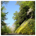
Ohio’s first township park, Mill Creek retains its dramatic, scenic hemlock gorge and sandstone cliffs that contrast with pastoral lakes, drives, and meadows. It provides both active and passive recreation spaces in a carefully designed setting.
References
Mahoning Valley Historical Society Archives, Youngstown, Ohio.
Mill Creek MetroParks Archives, Canfield, Ohio.
Potter, Carol, and Rick Shale. Images of America: Historic Mill Creek Park.Charleston, SC: Arcadia Publishing, 2005.
Rogers, Rebecca M., “Mill Creek Park Historic District,” Mahoning County, Ohio. National Register of Historic Places Inventory-Nomination Form, 2005. National Park Service, U.S. Department of the Interior, Washington, DC.