


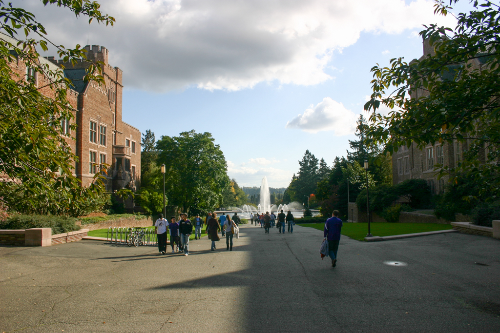

Rainier Vista forms an axis that today links Red Square, at the heart of the University of Washington campus, to a distant view of hills, lakes, and Mount Rainier to the southeast. This axis was the major organizational element of the Olmsted Brothers’ plan for the Alaska-Yukon-Pacific Exposition (AYPE) of 1909, and that the axis has been maintained for more than a century suggests the importance of open space and vistas to the university’s physical legacy, though most buildings constructed for the fair are no longer extant. Even when conditions are too cloudy for the mountain’s visibility, this grand, sloping pathway through the center of campus, defined on its edges by Collegiate Gothic architecture, groves, gardens, and the large, circular Drumheller Fountain, marks one of the nation’s most spectacular campus promenades.
Organizers for the AYPE chose the predominantly undeveloped lower section of the university grounds to develop the fair, and came to an agreement with the university’s regents to return the fairgrounds, minus any temporary construction, to the university at its conclusion. The fair’s exhibits, held in temporary buildings designed in a Beaux-Arts classical style, promoted Seattle as a gateway to the Pacific and Alaska and attracted over three million visitors. The fair’s formal layout, focusing on axes, pools, and views to significant landmarks followed the example of the 1893 World’s Columbian Exposition in Chicago, which itself followed a history of plans that gained initial definition in Sixtus V’s Plan for Rome in the seventeenth century.
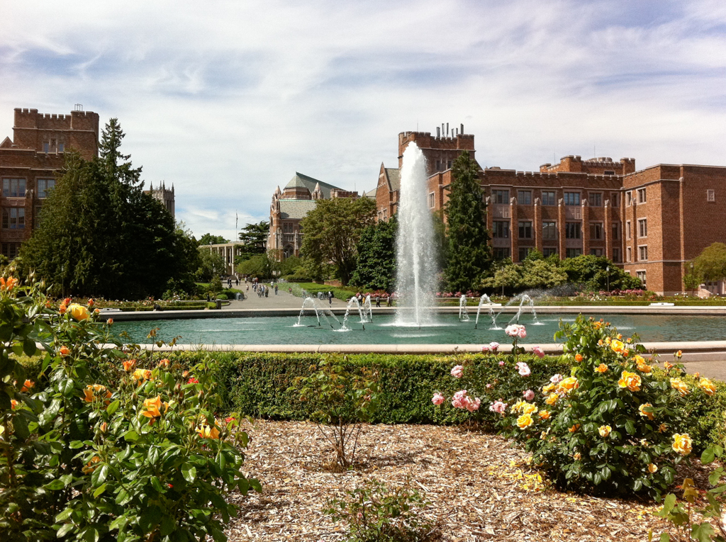
As part of the AYPE plan, the Olmsted Brothers designed a 500-foot water cascade to flow down the Rainier Vista walkway at 8,000 gallons per minute and terminate in an inner and outer pond, called Geyser Basin. The cascade operated during the fair, but only the ponds were retained after it closed. The outer pond is now under the circular walkway ringing the inner pond, and has, in the past, served to store water for the university power plant. The inner pond, which featured a single jet fountain during the fair, was retained and came to become colloquially known as “Frosh Pond” because of a tradition of tossing freshmen into it. The inner pond was provided with further definition when landscape architect Lawrence Halprin designed a lighted fountain, surrounded by a concrete base, with three banks of jets surrounding a center jet capable of reaching 100 feet. The fountain was funded by Joseph Drumheller, for whom it is named.
Although the university has undergone several campus plans since the AYPE, the formal arrangement and spirit of the Rainier Vista have remained central to the overall campus vision. Several buildings have been constructed on either side of the axis over the years, including several buildings comprising the loosely defined “Science Quadrangle,” and its lower portion was given further definition in 2015 by the landscape architecture firm of Gustafson Guthrie Nichol (GGN) with a land bridge bringing pedestrians and cyclists from a light rail station on the southeastern edge of campus. With the light rail station providing a new entrance to campus for thousands of commuters daily, the promenade likely will continue to provide an enduring vista for campus into the next century.