

-
 (Photograph by C. Ian Stevenson)
 -
 (Photograph by C. Ian Stevenson)
 -
 (Photograph by C. Ian Stevenson)
 -
 (Photograph by C. Ian Stevenson)
 -
 (Photograph by C. Ian Stevenson)

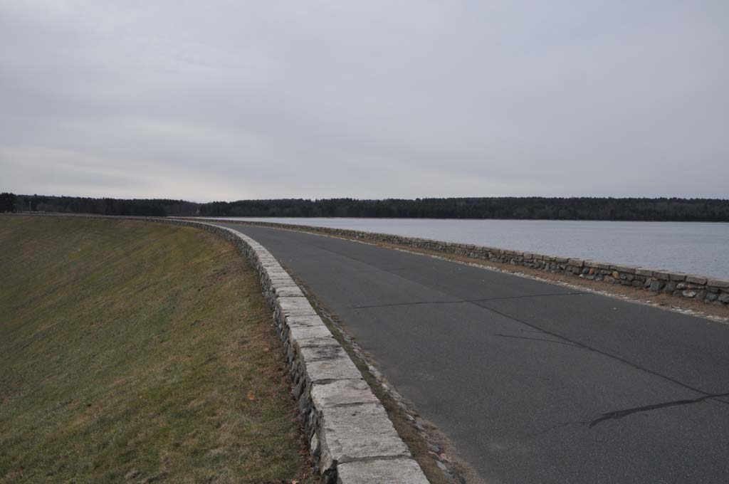
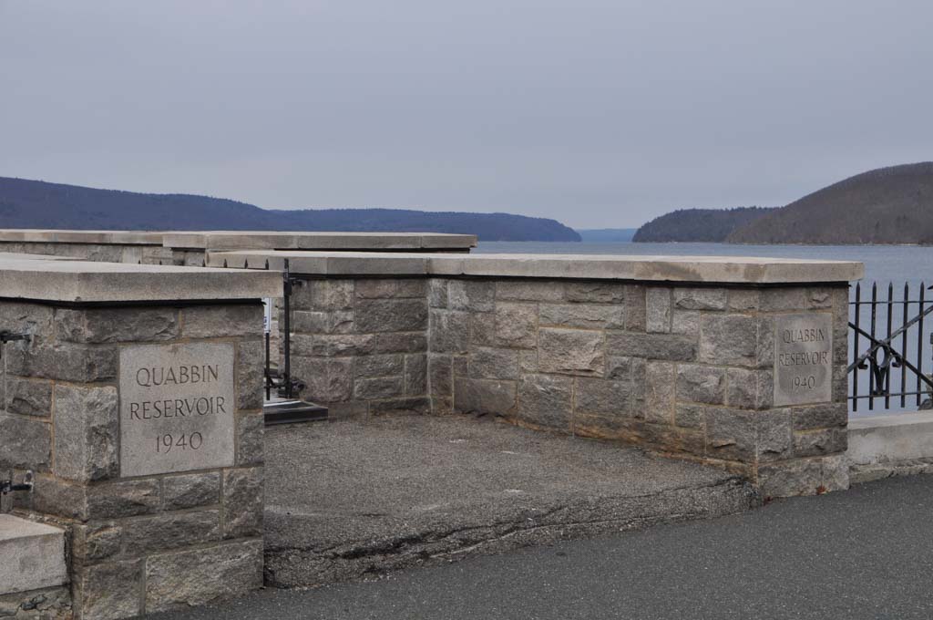


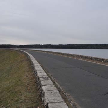
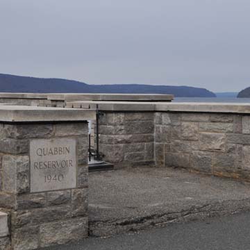
The bucolic Quabbin Reservoir seems at first glance to be a natural landscape, but is, in fact, one of the most important elements of Massachusetts’s built environment and urban infrastructure. Begun in 1926, completed in 1939, and finally filled in 1946, the Quabbin is the cornerstone of the Massachusetts Water Resources Authority’s supply of fresh water to the City of Boston, some 65 miles to the east, as well as 40 other communities in the greater metropolitan area. While the reservoir lies in a relatively uninhabited part of the state, its creation involved social and physical upheaval including the disincorporation of four towns, the disinterment of massive numbers of graves, the erection of two large earthen dams, and the construction of a 25-mile-long aqueduct tunnel—one of the longest in the world. With its accompanying Colonial Revival administration building complex and Classical Revival cemetery building, the Quabbin Reservoir is a testament to the interest of state leaders in the developmental possibilities of Massachusetts’s natural resources in the twentieth century. The reservoir’s calming landscape coupled with its aesthetically pleasing architecture sought to smooth public concern over the project and its power politics.
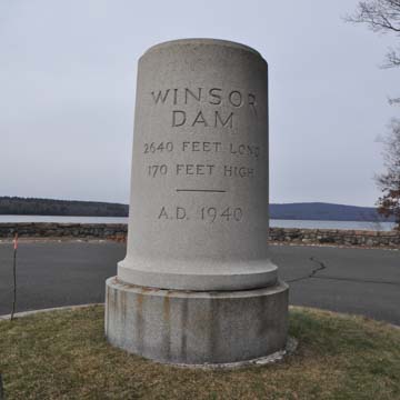
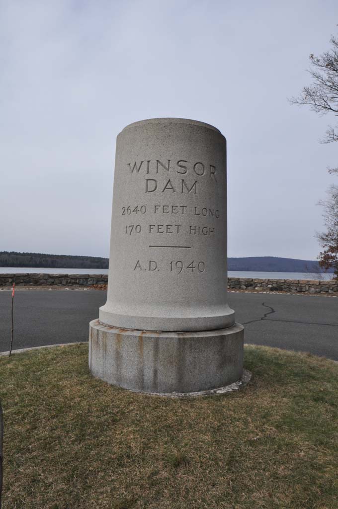
The idea for a water supply from the Swift and Ware river watersheds originated in 1895 when the Massachusetts General Court created the Metropolitan Water Board. In 1922, proponents raised the concept again, receiving authorization from the state legislature in 1926 to create a reservoir there. Construction of the aqueduct connecting the forthcoming reservoir began in 1927 under the direction of Metropolitan District Water Supply Commission Chief Engineer Frank E. Winsor. However, early opposition by the State of Connecticut, which claimed that the dams diminished flow to its rivers, delayed construction of the actual reservoir until 1931, at which time the U.S. Supreme Court ruled in favor of Massachusetts. When construction was completed in 1939 and the Swift and Ware rivers were allowed to flow into the new basin, it took seven years to fill the Quabbin Reservoir to capacity. Since that time, it has provided the primary water source for Boston and has been heralded as a civic engineering marvel.
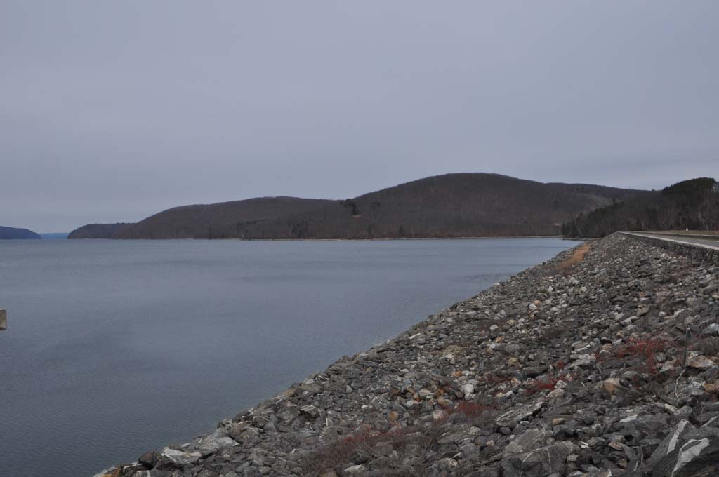
The Quabbin Reservoir results from the flooding of the Swift River Valley caused by the construction of two enormous earthen dams: the Winsor Dam (named for the chief engineer) and the Goodnough Dike (named for Boston’s Metropolitan Water and Sewer Board’s chair, X. Henry Goodnough), each over 2,000 feet long and built by the hydraulic fill method in which embankment materials were deposited by a stream of flowing water. The slightly greater Winsor Dam is one of the largest dams in the eastern U.S. and allows a maximum depth of 150 feet behind it. Other dams contribute to the maintenance of the Quabbin, including two earthen baffle dams, which control the route taken by water in the reservoir during long periods of storage, and two regulating dams. The latter two are earthen embankments with circular concrete spillways that are used to maintain a constant level of water in the shallow areas at the upper reaches of the reservoir. At capacity, the Quabbin Reservoir can hold 412 billion gallons and encompasses 38.6 square miles with 181 miles of shoreline. Supplanting an earlier agricultural landscape, the land surrounding the reservoir is now a heavily wooded planted forest, chiefly composed of conifers that are carefully harvested and continually replaced. Today, the Quabbin Reservoir is among the largest fabricated public water supplies in the nation and one of the largest unfiltered water supplies in the world.
The Quabbin Reservoir has provided other public benefits, notably as an employer at the height of the Great Depression through both state and federal funding made available through the Public Works Administration. The actively managed surrounding forest land provides lumber, and a spillway supplies water to a small hydroelectric plant. Moreover, its resultant landscape has generated tourism as a wildlife refuge and prime fishing area, though the state strictly prohibits direct water contact (such as swimming).
Despite these public benefits, the creation of the Quabbin remains a story of power politics. The vast trail network that now attracts visitors in large part reflects the locations of pre-existing but overgrown roads. In 1926, the Swift River Valley was not a vacant wilderness but an area with four towns—Dana, Enfield, Greenwich, and Prescott—in two counties (Hampshire and Worcester) that contained 34 cemeteries. In order to create the reservoir, the state demolished or relocated hundreds of houses, churches, schools, businesses, and industries. The recipients of this initiative had little recourse except to move and see the remains of their ancestors transferred either to the newly created Quabbin Cemetery or another of their choosing (at their own expense). Thus, the benefit for the state’s metropolis trumped the lifestyle of those in the center of the state.
References
Bowers, M.H. “Form A – Area: Quabbin Reservoir, Belchertown, MA (BLC.G).” Boston: Massachusetts Historical Commission, May 1985.
Bowers, M.H. “Form F – Structure: Middle Branch Regulating Dam, New Salem, MA (NSA.919).” Boston: Massachusetts Historical Commission, April 1985.
Bowers, M.H. “Form F – Structure: East Branch Regulating Dam, Hardwick, MA (PET.906).” Boston: Massachusetts Historical Commission, April 1985.
Tougias, Michael. Quabbin: A History and Explorer's Guide. Yarmouth Port, MA: On Cape Publications, 2002.