


The Los Angeles Plaza Historic District, once called the El Pueblo de Los Ángeles State Historic Park, and now known also as El Pueblo de Los Ángeles Historical Monument, is a historic district located at the oldest section of Los Angeles. It served as the city's core plaza under Spanish rule (1781–1821), Mexican leadership (1821–1847), and the United States government (after 1847) for much of the nineteenth century. Since its inception, the Plaza de Los Angeles has been used in a variety of ways, reflecting ongoing shifts in the needs and composition of the surrounding community. The forty-four acres surrounding the plaza and constituting the old pueblo have been preserved as a historic park roughly bounded by Spring, Macy, Alameda and Arcadia streets, and Cesar Chavez Boulevard (formerly Sunset Boulevard).
Los Angeles or El Pueblo de Nuestra Senora la Reina de los Angeles was established as the second pueblo in 1781 after the town of San Jose, which was founded in 1777. The plaza viejo (old plaza) was established by Governor Felipe de Neve as a rectangular plan oriented to the cardinal points. Per the Laws of the Indies, new settlements were to have four square leagues of land; that is, a distance marked by one league in each cardinal direction from the town center. The streets were laid out at forty-five degrees from the cardinal directions, likely to better fit into the landscape, a plan which is still preserved in downtown Los Angeles. As such, the plaza and streets provided protection from winds. The two streets on the longer sides of the plaza were the main arteries while the three on the shorter sides served more local use. House lots faced the square while other sites were designated for public buildings including a guard house, a town house, and a public granary. A portion was left as open space.
While traditionally credited to the Spanish Law of the Indies, the siting of the plaza as the center could also be attributed to local environmental knowledge of the complex Tongva population of the Yangna settlement in the region. The initial siting is proximal to the zanja madre (mother ditch) fed by the Rio Porciuncula, now known as Los Angeles River, which was important for providing access to water to the first pobladores (inhabitants). The plaza area was initially used for agricultural purposes in its early life.
Within the plaza, a plaque recalls the city’s founding, noting that “On September 4, 1781, eleven families of pobladores (44 persons including children) arrived at this place from the Gulf of California to establish a pueblo which was to become the City of Los Angeles. This colonization ordered by King Carlos III was carried out under the direction of Governor Felipe de Neve.” This small settlement was named El Pueblo de Nuestra Señora Reina de los Ángeles sobre El Rio Porciúncula, Spanish for “The Town of Our Lady Queen of the Angels on the Porciúncula River.” The original pueblo was sited just southeast of the current plaza along what we know today as the Los Angeles River; however, in 1815, a flood destroyed the pueblo, and it was relocated out of the flood area.
In 1818 a new plaza was established but without the clear geometry of the first one. House lots crossed the edges and only in 1838, after one house was demolished “to maintain the Plaza line,” did the city council aim to determine clear boundaries for the plaza. Commissioners addressed the fact that “certain imperfections which have been allowed to creep into the form of the Plaza through carelessness; and to add to the beauty of the town by embellishing the Plaza.” Fixing the boundaries included offering lot exchanges although not everyone agreed to make the move. Eventually the plaza was made more or less a regular rectangle. At this time it was likely treeless and open for public use as a common. The local church, Nuestra Reina de Los Angeles, sited along the plaza, became the center of community life for many residents.
In the 1820s the plaza hosted Mexican fiestas celebrating independence from Spain. During this period, the plaza was a commercial and social center. A reservoir serving as the terminus of the zanja madre, the original aqueduct bringing water to the pueblo from the Los Angeles River, was added around 1857. As the population increased, so did the use of plaza. The city grew to over 1,500 individuals by 1850. Just as California became part of the United States, Los Angeles was incorporated as a city. In 1859 city officials decided to clean up the plaza and enclose it with a picket fence; walking paths and small shrubs were also added. The reservoir was refashioned into an ornamental fountain at the center in 1870.
There was an influx of new residents in the 1880s and 1890s, which led to populations of 11,200 in 1880 to 102,500 in 1900. As the city grew, the commercial and cultural center began to move south away from the plaza, along Spring Street and Main Street. Strengthening its role, the Pueblo de Los Ángeles and the plaza became the end point of the Old Spanish Trail, a link between Sante Fe, New Mexico, and Los Angeles, California.
Despite the growth of the city, during the 1880s the Plaza de Los Angeles saw a decline in maintenance. The increase of prostitution in the area, in addition to standing water and garden beds filled with litter led to the dramatic decision to raze the trees and bring in new infrastructure. Reinvestment in Los Angeles Plaza Park meant the introduction of new plant beds, ornamental iron fences, and fountains. Main Street was a common pedestrian route for depot workers passing through the plaza and into their hotels in the 1880s. These changes reflected the pursuit of the ideal American city, or Victorian garden parks, versus the Mexican Pueblo.
In 1926, Christine Sterling began a public effort to preserve what she thought was the appropriate Mexican heritage of the neighborhood and plaza. Olvera Street, today a Mexican market and tourist attraction, was her accomplishment. While many backed her, there were other local residents who did not agree with her designated history of the landscape and public spaces as it privileged a narrow history rather than the broader historic narratives of the city and plaza. The debate around the mural America Tropical by David Siqueiros was a part of this disagreement. The mural has since been conserved by the Getty Conservation Institute and is now open to the public.
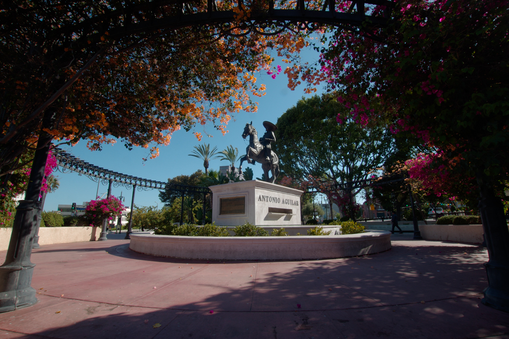
One of the last major transformations of the Los Angeles Plaza Park was the construction of U.S. Highway 101 in 1954, which led to the demolition of a number of historic buildings. Today the Old Spanish National Historic Trail, established in 2002, offers museums, historic sites, and markers along the route that begin to narrate the story of the regional landscape and cultures. The plaza hosts monuments to three recognized figures in the city’s history: King Carlos III of Spain, the monarch who ordered the founding of the Pueblo de Los Ángeles in 1780; Felipe de Neve, the Spanish Governor of the Californias who designated the site for the Pueblo and laid out the first plan; and Junípero Serra, founder and first leader of the Alta California missions, recognized throughout California.
Overall, pluralism has been an instrumental part of changes in the park and its uses. In time there was a deterioration of public space as a result of disinvestment. To this day the plaza remains contested space as it engages the historic narratives of multiple communities and cultures. Historian William David Estrada writes that the plaza incorporates multiple histories, including Chicano and Latino. The Plaza de los Angeles and the El Pueblo Historical Monument district attracts tourists and locals alike, including transient populations to a number of businesses selling foods and mementos, a number of art galleries bridging the cultural histories of the region, as well as the expansive and accessible open space promoting pluralism in the historic center of Los Angeles.
References
Estrada, William David. The Los Angeles Plaza: Sacred and Contested Space. Austin: University of Texas Press, 2008.
Guinn, J. M. “The Story of a Plaza.” Annual Publication of the Historical Society of Southern California and Pioneer Register, Los Angeles 4 (1898) 247-256.
Nunis, Doyce B., Jr. The Founding Documents of Los Angeles: A Bilingual Edition. Los Angeles: Historical Society of Southern California and Pasadena: Zamorano Club of Los Angeles, 2004.
Rios-Bustamante, Antonio. Mexican Los Angeles: A Narrative and Pictorial History. Encino, CA: Floricanto Press, 1992.