

La Vecindad cerca del Centro; Snob Hollow
You are here
El Presidio


1775–1783, Lt. Col. Hugo O’Conor, surveyor; c. 1860–1920. Roughly bounded by W. 6th St., N. Stone Ave., W. Alameda St., and N. Granada Ave.


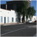
El Presidio is the oldest and longest inhabited part of modern-day Tucson and it preserves the origins of the city’s urban layout. As its name suggests, it was the fortified settlement established by Spanish colonists when southern Arizona was under that country’s dominion. Nothing of the compound remains, save for a few Sonoran-style adobe residences built by Mexican settlers in the mid-nineteenth century. Despite its origins, El Presidio is one of the first “American” residential neighborhoods in Tucson, and it reflects the building traditions of Anglo-Europeans who settled in the area following the Gold Rush of 1849. The well-established neighborhood contains nearly ninety architecturally or historically significant buildings, mostly houses and dating primarily from circa 1860 through circa 1920.
Through the eighteenth century and the first two decades of the nineteenth century, present-day southern Arizona was part of the Sonora Province, the northern frontier of the Viceroyalty of New Spain, far removed from the colonial capital in Mexico City. Although a visita (a satellite church lacking a resident priest) had been founded in the Tucson Basin earlier, the settlement at Tucson really began with the establishment of the presidio itself in 1775. The ten-acre Presidio San Agustin del Tucson was laid out by an Irish mercenary, Lieutenant Colonel Hugo O’Conor, on the east side of the Santa Cruz River, opposite the fortified San Agustin Mission. The presidio’s timber palisades were a defensive measure against Apache natives. By 1783, the massive adobe walls were completed, and the random street layout within the compound held a chapel, soldiers’ barracks, a store, a saloon, two graveyards, and two irregularly shaped plazas.
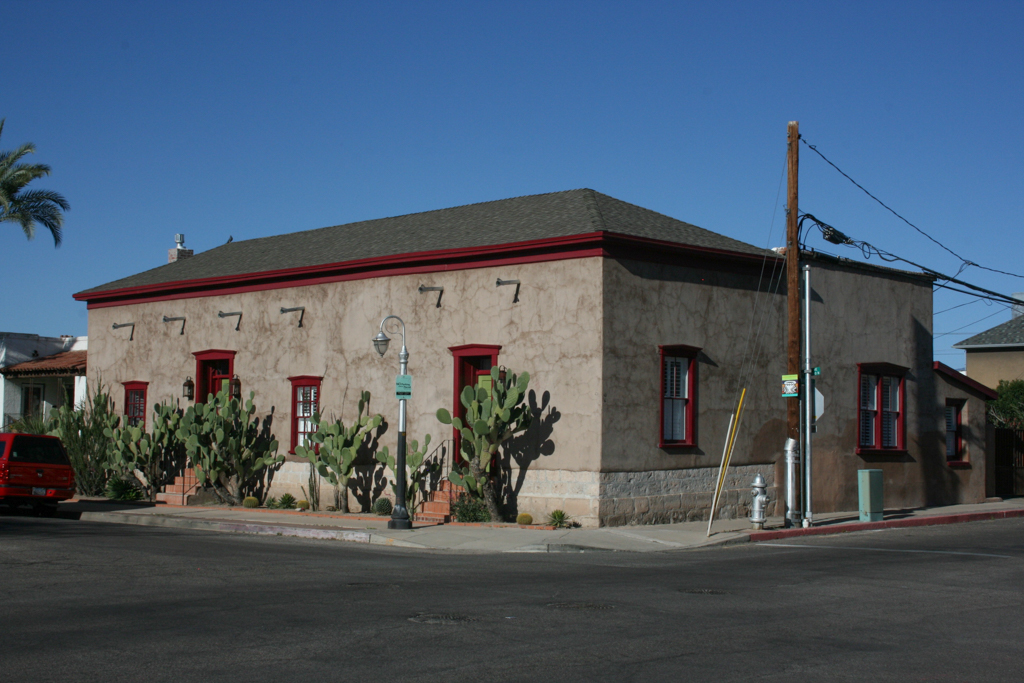
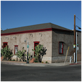
Between 1821 (when Mexico gained independence) and 1853 (when the United States bought the northernmost expanse of the Sonora Province through the Gadsden Purchase), Tucson grew slowly: in 1840, fewer than 400 people dwelled within the presidio walls. A few civilian buildings arose outside the main gate on the west side, near the Santa Cruz River and along the Calle Real, but the constant menace of raiding Apaches stymied extramural growth. Residences were attached, built in rows against the interior of the bounding walls in a “Sonoran” style that blended Spanish Colonial architecture with aspects of local building practices based on Ancestral Puebloan traditions of earlier centuries. The one-story, rectangular buildings utilized adobe bricks and stone, with minimal wood. These buildings were rudimentary in construction, utilitarian and homogenous in form, and accommodated a variety of functions. They posed contiguous, defensive walls on the street, with private spaces on the interior of the block. Examples include the oldest building in Tucson, La Casa Cordova (Cordova House, 1848), as well as the Edward Nye Fish House (1868) and the adjoining Hyram Stevens-Duffield House (1865). Although the presumed construction dates of these houses place them at the end or after Mexican control, their alignment with the original presidio suggest that parts of each house may have been built earlier. These houses also typify Sonoran construction: thick adobe walls punctuated by few and small apertures; minimal ornamentation on planar surfaces; tall and ocotillo-ribbed ceilings. The Fish and Stevens-Duffield houses both exhibit a zaguan plan, in which a center hall leads from the front entrance to the rear patio or courtyard, typical of colonial Mexican vernacular architecture.
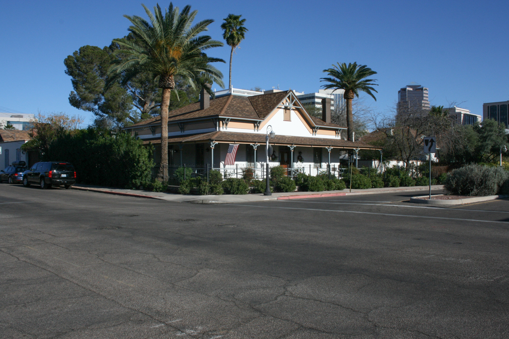
By 1856, the Mexican garrison left Tucson and the United States Army occupied the fort until 1862, when it was abandoned for nearby Camp Lowell and left to deteriorate. In 1863, Arizona became a territory of the United States, and as the Apache threat diminished due to the presence of the U.S. Army, Tucson’s population grew rapidly as Anglo-Europeans moved westward. The presidio was drastically altered at this time: its medieval, organic patterns of growth were subsumed by the Cartesian orthogonality of an urban grid and expansion grew northward along the Calle Real, renamed Main Avenue. While the contiguous Sonoran buildings had defined open space (both public plazas and private interior courtyards), American buildings were conceived as detached objects set in space. This suburban ideal transformed the fabric of the former presidio, an area known as “La Vecindad cerca del Centro,” into an “American” neighborhood in which houses were set in the center of lots, surrounded by expansive and irrigated lawns. Early Anglo-European settlers had adopted the Sonoran style of architecture, but they transformed it into the hybrid Territorial Style, in which low-slung, rectangular forms were dressed with shed or hipped roofs, larger fenestration, and verandas; they often had setbacks for front yards. The Troy McCleary House (circa 1886), with a pyramidal roof and portico attached to an older adobe building, represents this transitional house type in El Presidio.
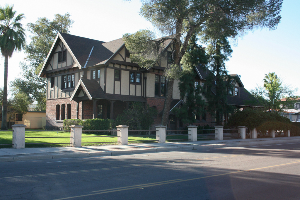
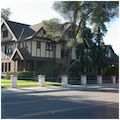
With the arrival of the railroad in 1880 (at which point Tucson’s population surpassed 7,000), native building practices were abandoned in favor of “modern,” Victorian-era styles that favored ornamentation and building materials previously unavailable in Arizona. Trains carried eastern styles and tastes to Arizona, along with master carpenters and trained architects, and materials like milled lumber, glass, and brick. Houses grew to multiple stories, with sleeping porches on the rear, and other elements common to residential architecture “back East.” The train tracks themselves sliced a diagonal line through the township’s newly platted northeast quadrant, drawing development away from the presidio, which became an affluent, white neighborhood known as “Snob Hollow” at the turn of the twentieth century when Tucson’s neighborhoods became ethnically segregated. Houses of the 1890s and 1900s were built in styles then popular nationwide, such as British and Spanish Colonial Revivals, Prairie-style bungalows, and the Mission Revival.
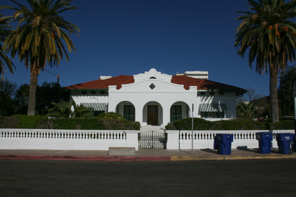
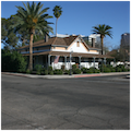
Notable El Presidio residences from this period include the J. Knox Corbett House (1907–1908) and the Levi Howell Manning House (1907–1908). The three most prolific Tucson architects of this era were Henry Jaastad, David Holmes, and Henry C. Trost. Holmes (of Holmes and Holmes) was responsible for the Mission Revival Corbett House. Built for a lumber dealer, it occupies the center of its lot, secluded from the public sphere and demarcated by a low, balustrade wall separating the sidewalk from the private yard, with a porch negotiating the entrance to the main core. The Manning House, its design attributed to Levi Manning’s wife Gussie Lovell O’Connell Manning, exudes revivalist whimsy and eclecticism, with its two cylindrical turrets and an angular plan of two wings connected by an arched loggia. Trost designed a number of fine residences in El Presidio that manifest the Mission Revival style intriguingly paired with Sullivanesque details, including the Hereford House (1900–1902) for attorney Frank Hereford and the First and Second Owls Clubs (1899–1900; 1902–1903) for rancher Levi Manning. All three houses are neighbors, making the 300 block of North Main Avenue an assemblage of Trost’s early work in Tucson.
As was the case in many urban neighborhoods in American cities, the fortunes of El Presidio waned in the mid-twentieth century. Urban renewal, particularly an effort to modernize downtown Tucson with a vast civic and convention center complex, resulted in the destruction of the historic barrios to the south between 1967 and 1970. These had once connected El Presidio to the present Barrio Viejo, and the destruction of these core neighborhoods meant the displacement of hundreds of Hispanic, African American, and Chinese residents who historically inhabited them. This loss galvanized the city’s historic preservations, who worked with local architects to draw attention to El Presidio’s importance. Beginning in the 1970s, El Presidio’s oldest buildings were stabilized and rehabilitated for residential and nonresidential uses. The neighborhood was listed as a historic district in the National Register of Historic Places in 1976.
References
Nequette, Anne M., and R. Brooks Jeffery. A Guide to Tucson Architecture. Tucson: University of Arizona Press, 2002.
Patterson, Ann, and Mark Vinson. Landmark Buildings: Arizona’s Architectural Heritage. Phoenix: Arizona Highways, 2004.
Stewart, Janet Ann, “El Presidio Historic District,” Pima County, Arizona. National Register of Historic Places Registration Form, 1975. National Park Service, U.S. Department of the Interior, Washington, D.C.
Wilson, Marjorie H., and Thomas S. Rothweiler, “Levi H. Manning House,” Pima County, Arizona. National Register of Historic Places Registration Form, 1979. National Park Service, U.S. Department of the Interior, Washington, D.C.
Writing Credits
Coordinator:
R. Brooks Jeffery
Jason Tippeconnic Fox
If SAH Archipedia has been useful to you, please consider supporting it.
SAH Archipedia tells the story of the United States through its buildings, landscapes, and cities. This freely available resource empowers the public with authoritative knowledge that deepens their understanding and appreciation of the built environment. But the Society of Architectural Historians, which created SAH Archipedia with University of Virginia Press, needs your support to maintain the high-caliber research, writing, photography, cartography, editing, design, and programming that make SAH Archipedia a trusted online resource available to all who value the history of place, heritage tourism, and learning.