

Fort Sheridan
You are here
Town of Fort Sheridan
1889–1893, Holabird and Roche; Ossian Cole Simonds, landscape architect; 1893–1910, Office of the Quartermaster General. Old Elm Rd. and Sheridan Rd.
-
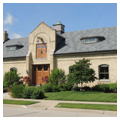
 Officer's House (Photograph by Jean Follett)
 -
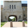
 Water tower, view from south (Photograph by Jean Follett)
 -
 Water tower, detail at north base (Photograph by Jean Follett)
 -
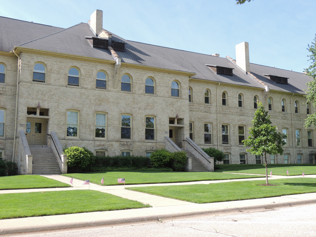
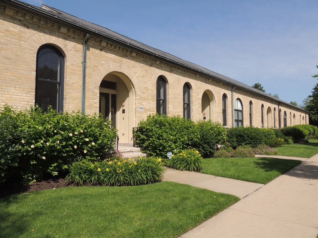
 Barracks (Photograph by Jean Follett)
 -
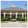
 Administration Building (Photograph by Jean Follett)
 -
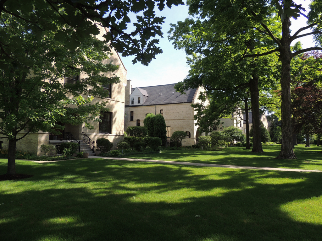
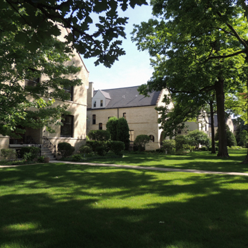 Officers' Loop (Photograph by Jean Follett)
 -
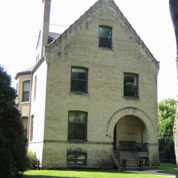
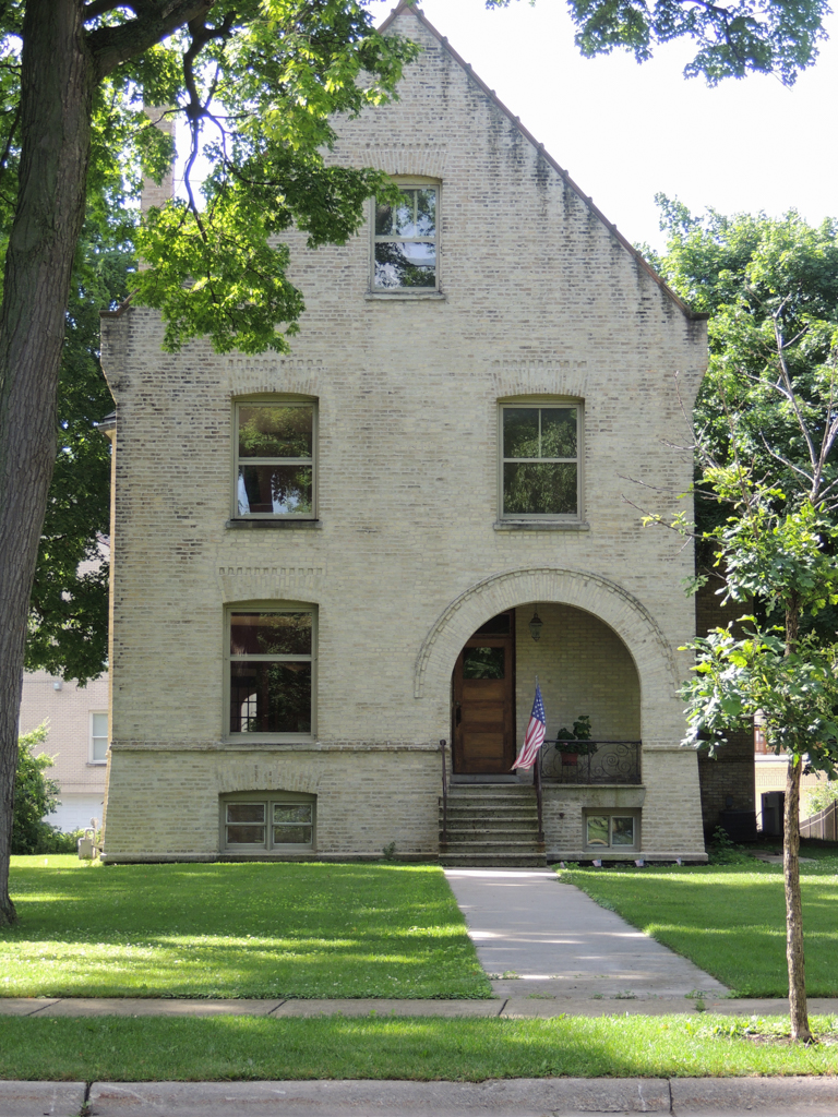
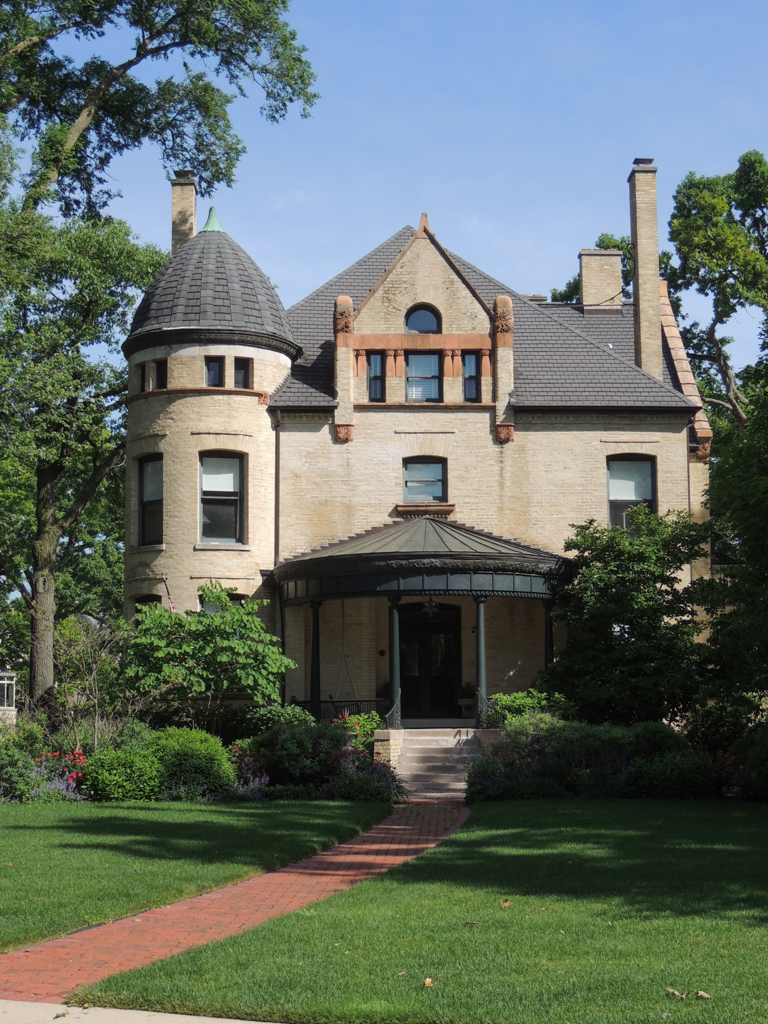
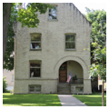
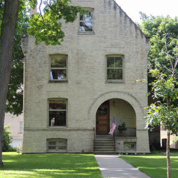 Officer's House (Photograph by Jean Follett)
 -
 (Photograph by Jean Follett)
 -
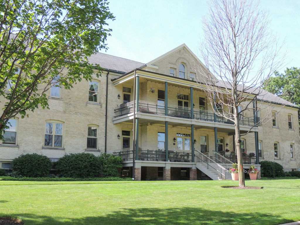
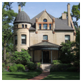
 Commander's House (Photograph by Jean Follett)
 -
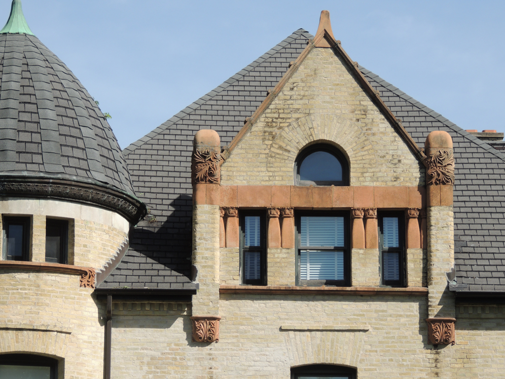
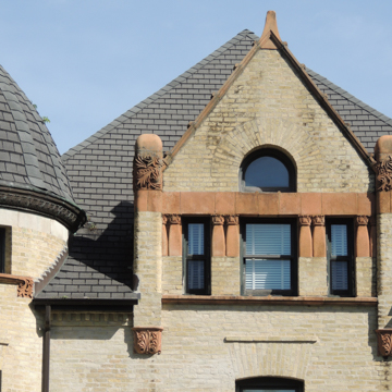 Detail, Commander's House (Photograph by Jean Follett)
 -
 Officers' Club (Photograph by Jean Follett)
 -
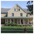
 Duplex Housing (Photograph by Jean Follett)
 -
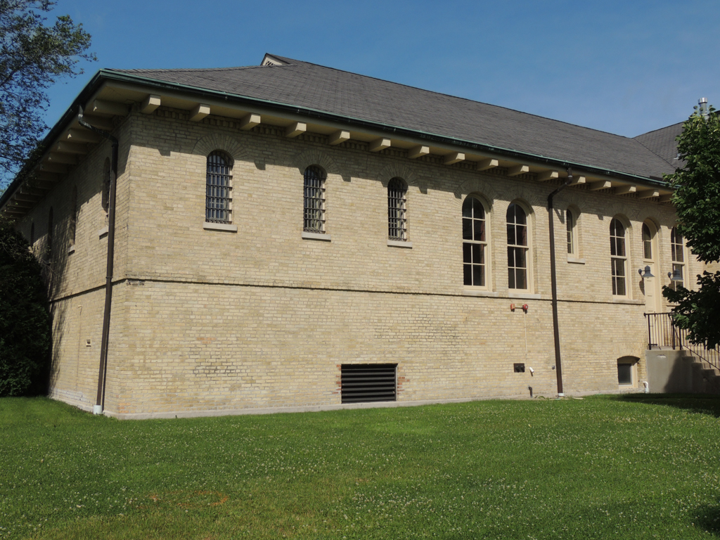
 Jail (Photograph by Jean Follett)
 -
 Jail (Photograph by Jean Follett)
 -
 (Photograph by Jean Follett)
 -
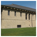
 Workshops (Photograph by Jean Follett)
 -
 Barn (Photograph by Jean Follett)


Fort Sheridan is a monument to the Army’s ambitious build-out of new, comprehensively planned forts across the United States at the end of the nineteenth and beginning of the twentieth century. With 66 buildings by Holabird and Roche of Chicago and a landscape by Ossian Cole Simonds, the Fort stands as a cohesive lakefront ensemble despite the disruption of late-twentieth-century infill housing.
In the 1880s the Army began to close temporary posts throughout the old Northwest Territory in favor of permanent garrisons. Chicago, with its central location and critical railroad connections, was a logical and strategic location. Labor unrest in the Chicago area during the 1880s, culminating in the Haymarket Riot of 1886, led a group of Chicago businessmen to petition the government for a new Army post that would protect the city and its citizens. In other cities, such as New York and Boston, this same impulse led to the construction of major armories. But in Chicago, the push was on for a full-blown Army post. In 1887 over 600 acres on the shore of Lake Michigan north of the city were purchased for the development of Fort Sheridan.
Although the Army was beginning to develop standardized plans for the new “hollow square” fort, these were not yet complete in 1889. Furthermore, the Quartermaster General, Brigadier General Samuel B. Holabird, had a son with a young architectural practice in Chicago. So, for the first and last time, the Army commissioned a single architectural firm to design an entire Fort, of lasting benefit to the firm of Holabird and Roche and to the overall quality of the Fort’s buildings and landscapes. To prepare the Fort’s site plan, Holabird and Roche turned to Simonds, whom they met while the three young designers were working for William LeBaron Jenney.
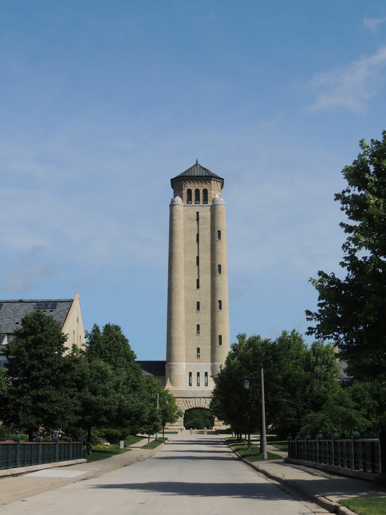
Simonds centered the Fort on a bluff between two lakeside ravines, creating a 54-acre parade ground with the Fort’s buildings laid out around it in a series of curving roads and loops, all with naturalistic plantings. The plan is anchored by a soaring water tank tower, containing an archway to accommodate marching troops. Like all army posts, this one reflects both the need for ceremony and the importance of rank. The many facilities for horses and their care also indicate the continuing importance of horses in nineteenth-century Army operations.
The Fort was entered from the west, opposite the parade ground, providing a breathtaking view of the entire complex. The officers’ houses were built on three lakeside loops to the east of the parade ground. A fourth loop contained the hospital, close to the fresh air off the lake and removed from the Fort’s main activities. Enormous two-story barracks on raised basements flanked the central tower, creating a continuous wall across the south side of the parade ground. Located north of the parade ground were housing and a club for non-commissioned officers and bachelor officers, as well as guests. A military cemetery was established further to the north; to the east, a pump house was built on the shore of the lake. In the Fort’s southwestern quadrant were all of the many service functions, including stables, a veterinary hospital, blacksmith shop, bakery, mess hall, drill hall and the heating plant.
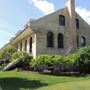
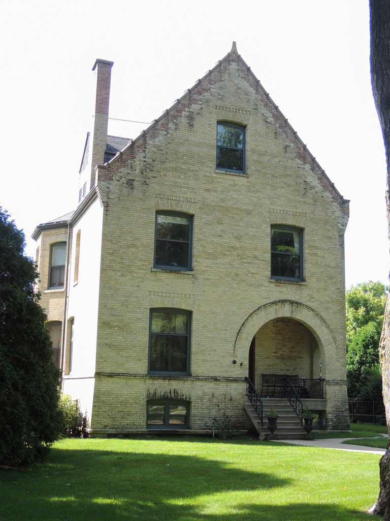
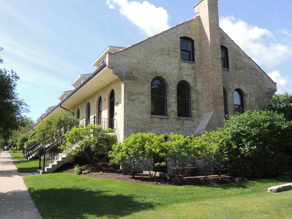
The buildings are all constructed of a soft, grainy yellow brick that was manufactured at the Fort. Holabird and Roche kept their designs simple, with gabled, slated roofs, wrought-iron railings, and both Romanesque and segmental arches. Brickwork and terra-cotta provide sparse ornamentation, likely reflecting the Army’s need for economy. Only the two Commanders’ houses on Logan Loop are more elaborate—their large, irregular masses are decorated with Queen Anne turrets, curving porches, and large dormers.
The tower (its original 228-foot-height was reduced by 60 feet in 1949) marks the Fort’s presence from both inside and outside the gates. It is beautifully detailed with a broad Richardsonian Romanesque arch at the base, carved foliate detailing, rounded columnar corners, and a graceful hipped roof above an open arcade.
The central tower is flanked by two long, subtly receding ranks of barracks. As was typical of Army installations, every residential building had a level of detail that communicated the rank of those living in it: the plainer the building, the lower the rank. The first set of barracks has simple stone stairs leading up to plain facades with double-hung windows and shallow dormers. The next set has round-arched windows on the second floor. The third set has porches under pedimented gables facing the parade ground. Behind this 1,000-foot wall of barracks are buildings that housed service functions related to feeding the troops and laundering their clothes.
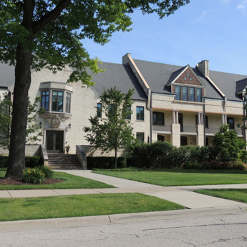
The genius of Simond’s plan and the responsiveness of Holabird and Roche to the Army’s need for ranked housing is even more evident on the eastern end of the parade ground. Here, flanking a small ravine, is a series of three short, picturesque loops, each loop housing married officers of different ranks. Each married officer was assigned a private house that was sized and ornamented accordingly. Most of these houses are simple rectangles with Richardsonian Romanesque-arched porch openings, terra-cotta roof copings, and the oversize entry halls and decorative stairways typical of the period. Naturally, the largest and most elaborate house was given to the Commander and stands at the end of the southern loop, overlooking Lake Michigan. Its exceptional breadth and depth, deep semi-circular porch, rounded corner tower, and large, ornamental dormers are visual reminders of the Commander’s importance.
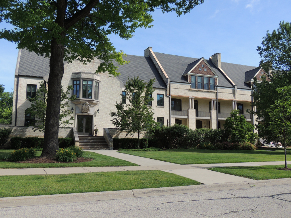
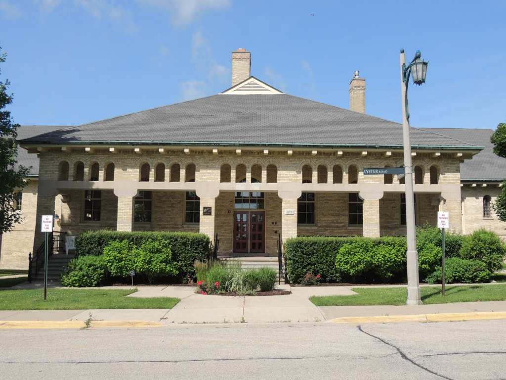
Although the Holabird and Roche buildings at Fort Sheridan were completed by 1893, additional structures were erected through World War II. Because of 1896 legislation prohibiting private architecture firms from designing military installations, the Fort’s remaining buildings were based on plans released by the Quartermaster General’s office. Twenty-six of these buildings still stand, including a 1932 theater that is now a community arts center.
As soon as it was operational, the Fort quickly became important to the Army’s work in the west, housing prisoners from the Wounded Knee Massacre in 1890 and providing troops during the Pullman labor strike in 1894. By World War I it was a well-established training and induction center. Its hospital treated 60,000 victims of the 1918 influenza epidemic. During World War II half a million men were processed through Fort Sheridan on their way to Army posts all over the world. Later, the Fort provided logistical support for the Nike-Hercules missile sites, with the Fort’s daily population peaking at 5,000 in 1975. The Fort became a historic district in 1984.
Despite its long and vital history, Fort Sheridan was part of the first round of military base closings in 1990. The Department of Defense had difficulty justifying the expense of bases that were no longer strategically located. Closed bases were repurposed in different ways. Some were preserved as public land; some became office parks. Unsurprisingly, at Fort Sheridan, the prime lakefront location, the combination of open space, and the existing building stock immediately attracted the interest of housing developers. Although 90 acres at the south end of the Fort were retained for training purposes, the rest of the Fort was officially decommissioned in 1993. It has since been redeveloped as “The Town of Fort Sheridan,” including reuse of all 66 of the Holabird and Roche buildings as well as 26 Quartermaster General structures.
References
Bachrach, Julia Sniderman. “Ossian Cole Simonds: Conservation Ethic in the Prairie Style.” In Midwestern Landscape Architecture, edited by William H. Tisher, 80-98. Urbana: University of Illinois, 2000.
Bruegmann, Robert. The Architects and the City: Holabird & Roche of Chicago, 1880-1918. Chicago: University of Chicago Press, 1997.
Butowsky, Harry, and Sally Kress Tompkins, “Fort Sheridan Historic District,” Lake County, Illinois. National Register of Historic Places Inventory–Nomination Form, 1983. National Park Service, U.S. Department of the Interior, Washington, D.C.
Hannah, Eleanor. “Fort Sheridan.” In Encyclopedia of Chicago. Edited by Janice L. Reiff, Anne Durkin Keating and James R. Grossman. Chicago: Chicago Historical Society, 2005.
Simonds, O.C. Landscape Gardening. Amherst: University of Massachusetts Press, 2000.
Writing Credits
Coordinator:
Jean A. Follett
Elizabeth A. Milnarik
James E. Peters
If SAH Archipedia has been useful to you, please consider supporting it.
SAH Archipedia tells the story of the United States through its buildings, landscapes, and cities. This freely available resource empowers the public with authoritative knowledge that deepens their understanding and appreciation of the built environment. But the Society of Architectural Historians, which created SAH Archipedia with University of Virginia Press, needs your support to maintain the high-caliber research, writing, photography, cartography, editing, design, and programming that make SAH Archipedia a trusted online resource available to all who value the history of place, heritage tourism, and learning.