


The Lewis and Clark National Historic Trail spans 3,700 miles and traverses tribal lands and 11 states, including Illinois, Missouri, Kansas, Nebraska, Iowa, South Dakota, North Dakota, Montana, Idaho, Washington, and Oregon. The trail traces the westbound and return routes of the Lewis and Clark expedition of 1804–1806.
In January 1803, President Thomas Jefferson requested $2,500 from Congress to fund an expedition to explore the western portion of the continent. Jefferson had sought information on the West as far back as 1783 when he asked George Rogers Clark, a Revolutionary War hero and elder brother of William Clark, to lead an expedition that ultimately never proceeded. The acquisition of the Louisiana Purchase in 1803 added to the importance of these information-gathering missions. Jefferson selected the 28-year-old Army Captain Meriwether Lewis to lead the Corps of Discovery. To supplement his military training, Lewis was dispatched to Philadelphia to be instructed in cartography, botany, surveying, math, and other disciplines Jefferson believed were required for an explorer. Lewis chose his former military colleague, William Clark, then 33, as the endeavor’s co-leader.
The expedition’s mandate was to find a water route connecting the Missouri River with the Pacific Ocean. Such a route would open commercial opportunities and establish an American presence in the West, denying foreign claims to the Pacific Northwest and its valuable resources. The expedition was also expected to explore and map the newly acquired territory of the Louisiana Purchase and establish trade relations with Native Americans en route.
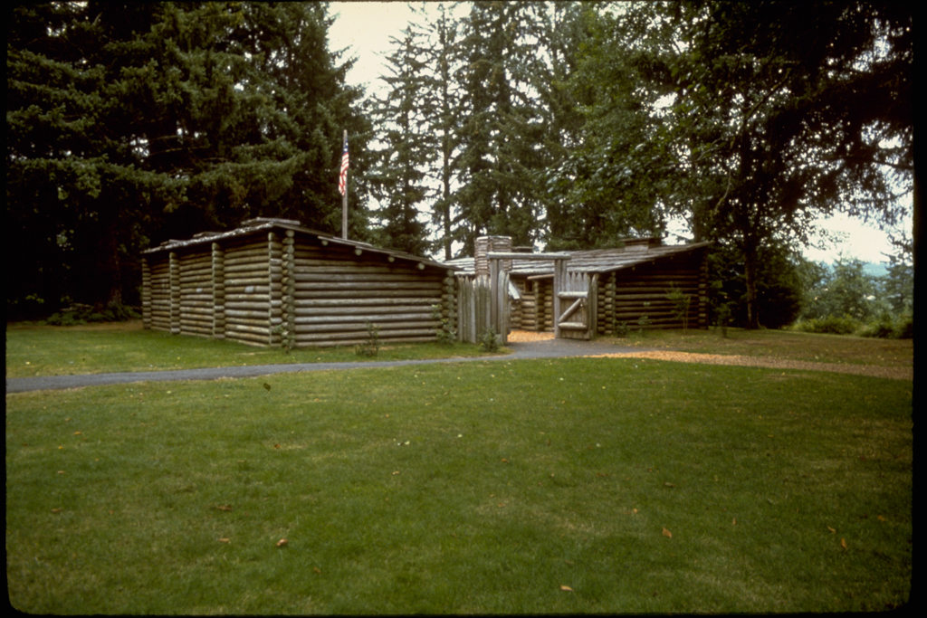
The Corps of Discovery departed from the mouth of the Wood River near St. Louis with more than 40 individuals and a dog named Seamen. Expedition members were recruited from local military and civilian populations, most chosen for specific skills. The party sailed up the Missouri River in a large keelboat, designed by Lewis, and two smaller pirogues. The round-trip journey lasted over 2 years. The route traversed a vast diversity of landscapes including the Great Plains, the Rocky Mountains, and the forests of the Pacific Northwest. In November 1805, the party reached the Pacific Ocean near present-day Astoria, Oregon, where they built Fort Clatsop. After staying for the winter, the party departed. Taking a slightly different return route, they arrived in Saint Louis on September 23, 1806.
National interest in the expedition waned for a century after its completion. In 1906, the Lewis and Clark Exposition in Portland, Oregon, celebrated the centennial of the venture. After the Exposition, efforts over the years included attempts to locate and travel the original expedition’s route and attempts to memorialize the expedition by marking the trail on a regional level. In 1964 Congress established the Lewis and Clark Commission to investigate possibilities for conservation of the sites and landscapes that marked the Corps of Discovery’s trek.
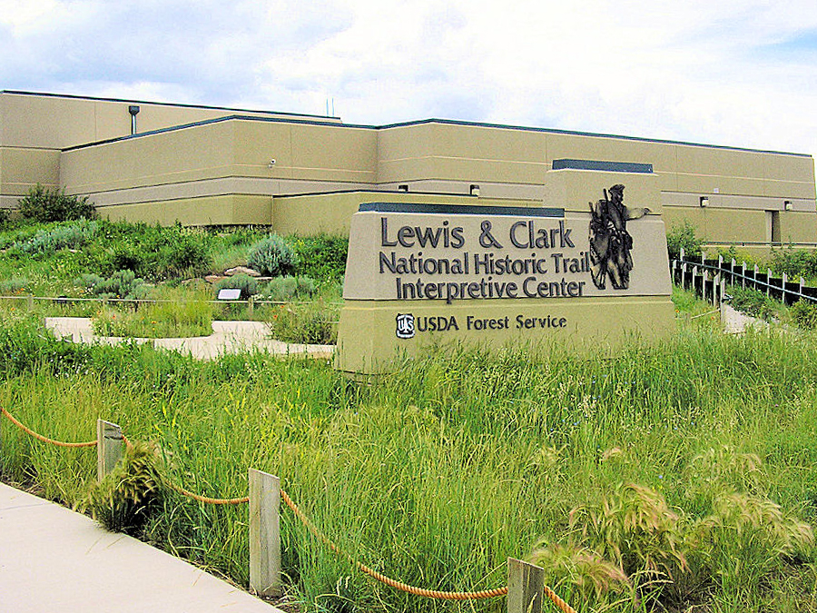
Today the trail comprises a series of sites ranging from interpretive centers to monuments to parklands and recreational opportunities connected by highways and roadways through 11 states. In addition to natural changes in the courses of the Missouri and Columbia rivers, the creation of dams and reservoirs has obscured or covered locations of the party’s original path. As a result, the trail is not a precise tracing of the historical route, but a close approximation of the Corps’ path. In addition to official sites designated by the National Park Service, a number of sites have been established and maintained by private groups. Visitors travel the trail’s entire length or in regional sections by motorized transport. Monuments and interpretive centers provide opportunities to place the expedition’s experience in the specific site or area. Along sections of the trail, recreational sites provide opportunities for hiking and boating as well.
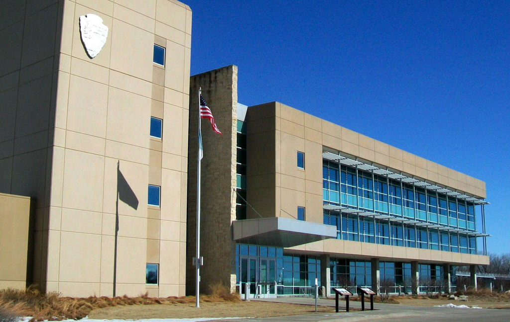
The Lewis and Clark National Historic Trail is run by the National Park Service, although some sites are managed by state and other federal agencies, tribal governments, and private organizations. The trail begins in Wood River, Illinois, and continues to Fort Clatsop, Oregon, and the Pacific Ocean. The Visitor Center is located at the Trail Headquarters in Omaha, Nebraska, within the National Park Service’s Midwest Regional Office.
Congress established the trail in 1978 as one of the first four historic trails under the National Trails System Act (NTSA). The NTSA was originally passed in 1968 to provide for the establishment of three types of trails: National Scenic Trails, National Recreation Trails, and connection or Side Trails. The law was amended in 1978 to include trails of national historic interest. The Lewis and Clark National Historic Trail was the longest of the four original historic trails established in 1978.
References
Lewis, M., William Clark, and Gary E. Moulton. The Lewis and Clark Journals, An American Epic of Discovery: The abridgment of the definitive Nebraska edition. Lincoln: University of Nebraska Press, 2003.
Lewis, W. In the footsteps of Lewis and Clark: Early commemorations and the origins of the national historic trail. Boulder: University Press of Colorado, 2010.
The National Trail Systems Act, U.S. Code 16 (2009): 1241-1251.
National Park Service. “Lewis and Clark National Historic Trail.” Accessed March 1, 2017. www.nps.gov.
National Geographic. “Lewis and Clark.” Accessed March 1, 2017. www.nationalgeographic.com.