

-
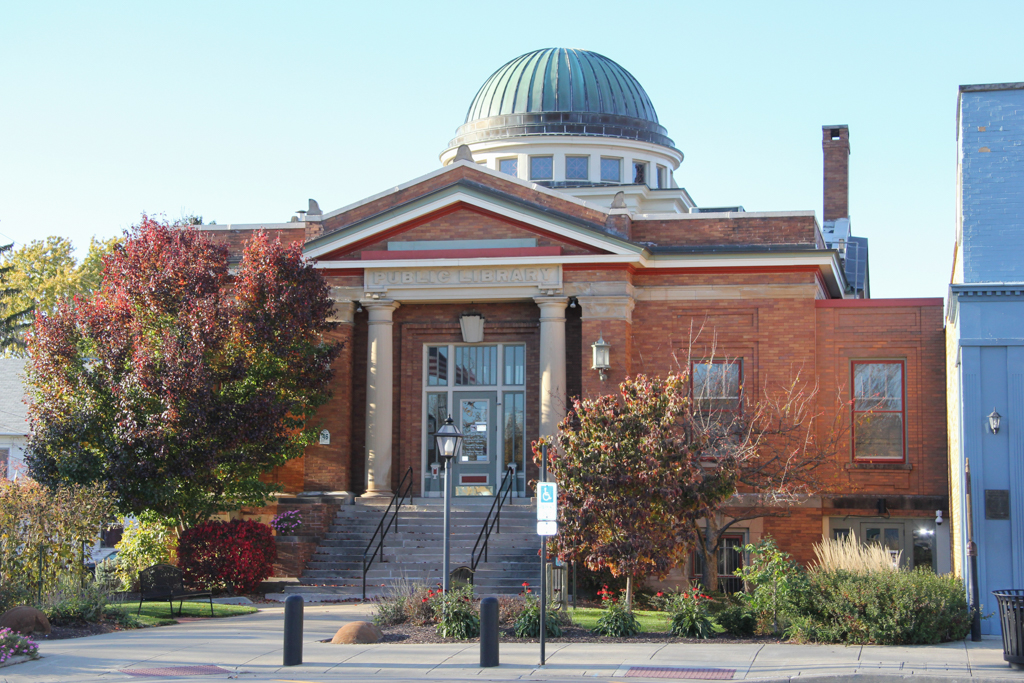
 83 W. Main St. (Photograph by Marcia E. Moll and Richard J. Sicha)
 -
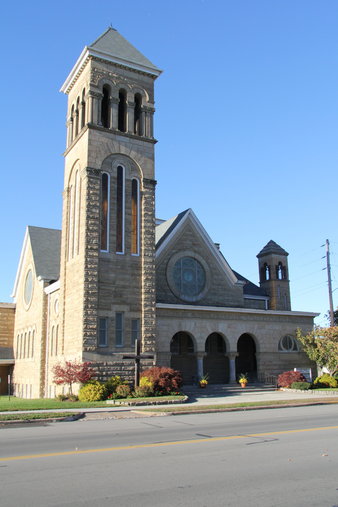
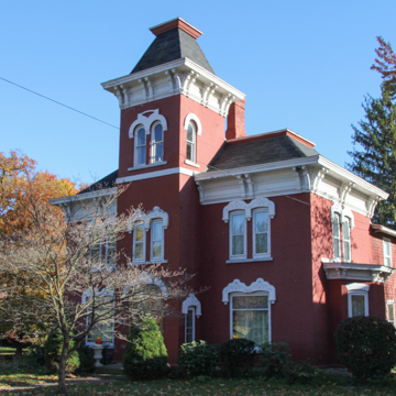 145 W. Main St. (Photograph by Marcia E. Moll and Richard J. Sicha)
 -
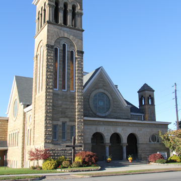 60 W. Main St. (Photograph by Marcia E. Moll and Richard J. Sicha)
 -
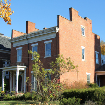
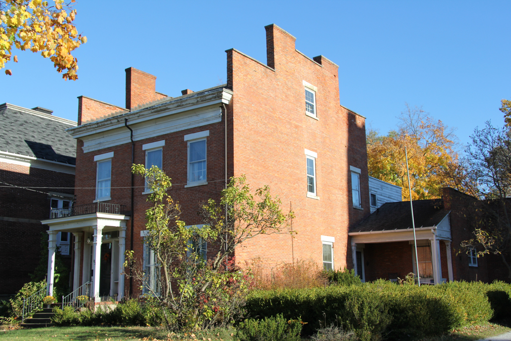
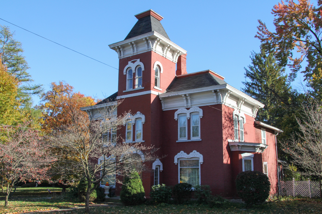
 46 W. Main St. (Photograph by Marcia E. Moll and Richard J. Sicha)


West Main Street in Norwalk, Ohio, is a residential district of substantial houses dating to the early nineteenth century, when the town was settled in association with the development of the Firelands section of the Connecticut Western Reserve.
The Western Reserve in what is now northeast Ohio was approximately 3.3 million acres of land that Connecticut had reserved for its citizens in 1786, in exchange for surrendering other western land claims to the United States government. The “Fire Sufferers Land” was the 500,000 acres in the westernmost part of the Reserve, set aside to be settled or sold as financial restitution for residents of the Connecticut towns of Danbury, East Haven, Fairfield, Greenwich, Groton, New Haven, New London, Norwalk, and Ridgefield, whose property had been destroyed during the Revolutionary War by British forces attempting to disrupt manufacturing and shipping.
Few of the original “Sufferers” settled in the distant Firelands, having sold their claims to land speculators who resold property to actual settlers. The area was still very remote when Ohio became a state in 1803, and although land was surveyed by 1808, nearby hostilities during the War of 1812 discouraged settlement. The entire Firelands was organized as Huron County in 1809. Norwalk, named for the eponymous Connecticut town, was established in 1817 and became the new county seat the following year. It was not until the late 1830s that Erie County was formed from the northern third of Huron County, and by that time Norwalk was a thriving commercial and industrial town with about one thousand inhabitants. Around 1850, Norwalk became part of the main railroad route connecting Chicago, Cleveland, and New York. During the next two decades its population tripled, from 1,437 to 4,498, as construction and repair shops servicing the railroad clustered in and around Norwalk.
Accompanying this growth and prosperity was the development of a fashionable residential district along a six-block stretch of West Main Street about one mile west of downtown Norwalk. The architectural legacy of this period is evident in four notable houses dating from the early 1830s, along with a seminary. The Kimball-Wooster-Martin House (1832) is in the Federal style; the Sturges-Kennan-Fulstow House (c. 1834), the Vredenburgh-Gardiner House (1834), and the Samuel Preston House (1835) represent the transition between the Federal and Greek Revival styles. The district also contains residences built through the remainder of the nineteenth and early twentieth centuries, including houses, churches, and a library in the Italianate, Gothic, Second Empire, Colonial Revival, and Prairie styles.
References
“A Brief History of the Firelands.” Firelands Museum. Accessed November 15, 2018. http://www.firelandsmuseum.org.
Johannesen, Eric, “West Main Street District,” Huron County, Ohio. National Register of Historic Places Inventory–Nomination, 1974. National Park Service, U.S. Department of the Interior, Washington, D.C.
Van Tassel, David D. and John J. Grabowski, eds. “Connecticut Land Co.” Encyclopedia of Cleveland History. Accessed November 15, 2018. http://ech.case.edu.
Van Tassel, David D. and John J. Grabowski, eds. “Western Reserve.” Encyclopedia of Cleveland History. Accessed November 15, 2018. http://ech.case.edu.