


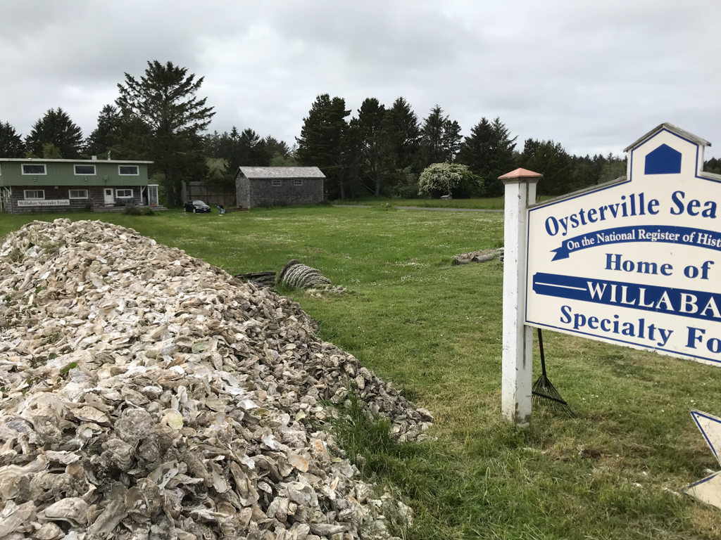


Located on the southwestern coast of Pacific County on a thin peninsula facing Willapa Bay, Oysterville is today a quiet and charming bayside village that reveals very little about its rough and tumble past. Established by Robert Hamilton Espy and Isaac Alonzo Clark in 1854, it began as a boomtown fueled by the resources found in the tideflats of what was then called “Shoalwater Bay.” The oysters in the tideflats had long been a food source for the indigenous populations in the region, but this would change when Espy, an enterprising young logger, struck up a friendship with Klickeas, chief of the local Chinook tribe. In the spring of 1854, Klickeas guided Espy and Clark, who had met the previous winter, to the oyster beds. Soon, the outlook of the town would be transformed.
For nearly a century beginning in the mid-1850s, Oysterville’s economy was closely tied to the fluctuating supply and demand for oysters. Initially, this demand came from San Francisco, where residents had developed a taste for fresh oysters and had the gold to afford them. Schooners hauled oysters away at a dollar a bushel basket and, in the late 1850s, roughly 100,000 baskets were harvested per year. In 1860, 90 percent of the oysters consumed in San Francisco were harvested in Shoalwater Bay. The population of Oysterville ballooned as fortune seekers, merchants, service providers, and their families converged on the tideflats, and the rough cabins built to house the first oystermen were soon joined by farmhouses, single-family dwellings, boatworks, hotels, saloons, general stores, and shops for a blacksmith, butcher, and a barber. In 1855, just one year after Espy and Clark arrived, Oysterville was selected as the county seat—a reflection of the thriving economy and growing population. According to the 1860 census, Oysterville’s permanent population was 210, but including transient workers and other temporary residents, the population hovered around 500.
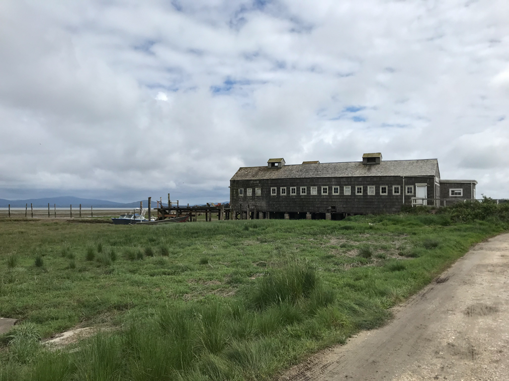
Several pivotal events in the late nineteenth century caused the first decline in the oyster population and subsequent decline in Oysterville’s commerce. Weather-related catastrophes damaged the ecology of the tideflats, and overharvesting further diminished the oyster population. In 1889, the Ilwaco Railroad chose to locate its terminus at Nahcotta, located approximately 3.5 miles to the south. The transfer of the county seat to South Bend in 1892 and the economic impact of the Great Depression also took a toll on Oysterville’s economy. Some of the buildings fell into disrepair, and some were lost completely. Out of necessity, townspeople began to rely on subsistence farming, and the area became more agrarian, with barns and outbuildings dotting the landscape. Oysterville experienced a brief resurgence beginning in the 1930s when a larger variety of Japanese oyster was introduced to the area, inspiring the construction of several canneries. The village became reasonably prosperous, but by the end of the 1950s Oysterville was once again in economic decline.
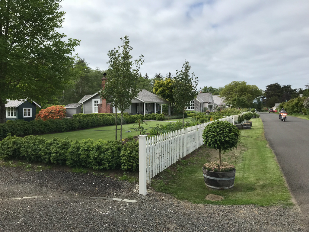
Construction dates of Oysterville’s built environment reveal the town’s cyclical economic history. The structures generally fall into three periods: eight houses survive from the town’s initial period of growth from the mid to late nineteenth century; nine houses exist from the brief period during the 1930s that coincided with the introduction of the Japanese oyster variety and the construction of canneries; and eleven houses, primarily serving as vacation homes, were built in the late twentieth century. The development that proliferated in nearby Ocean Park and Nahcotta was kept at bay in Oysterville.
A handful of surviving nineteenth-century structures are now part of the Oysterville Historic District—many of them residences built for the more prominent members of the community during the village’s early years. The historic district contains only one commercial building (the Cannery) and three public buildings: the Old Pacific Courthouse, Oysterville Church, and the Schoolhouse. All other commercial or public buildings have been lost to tide erosion, weather, or have been repurposed for other needs. The historic district is located in Township 12 North of Pacific County, and covers approximately 80 acres running half a mile north to south and a quarter mile east to west in a roughly five-by-two block configuration.
A handful of buildings and spaces that survive outside of the historic district tell equally interesting stories of the village’s history. A dairy barn built in the early 1930s and a number of smaller unadorned frame houses, for example, might be considered a material reflection of the leaner farming years in Oysterville. A few vacant spaces are marked with short histories of the structures lost to time, including the home site of Captain James and Jane Haquet Johnson, whose ancestors included chiefs of the Chinook and Quinault Tribes, and the site of the second Oysterville Courthouse and its jail. The post office building, though moved to its current location in 1919, is apparently the oldest, continuously run post office in the state.
Despite its sleepy disposition and diminished condition, Oysterville’s built environment still tells stories about the vicissitudes of the local economy and the lives of its former and current residents. Today, Oysterville is sustained largely through tourism, to which the historic district likely contributes. The popularity of the national bestseller book, Oysterville: Roads to Grandpa’s Village (1992) by Willard Espy, the grandson of founding father Robert Espy, may also contribute to the interest in the village. Oysterville is otherwise a quiet, unincorporated town with forty-eight residents according to the 2000 census, only twelve of whom are permanent residents. The town’s legacy remains tied to its historic relationship with the water, and the oysters harvested along its shores.
References
Espy, Willard. Roads to Grandpa’s Village.New York: Clarkson N. Potter Inc., 1977.
Stevens, Sydney. O is For Oysterville. Oysterville, WA: Privately published, 2000.
Stevens, Sydney. Images of America: Oysterville.Charleston, SC: Arcadia Publishing. 2010.
Stevens, Sydney. “A Walk Through the Oysterville Historic District.” Map. Oysterville Restoration Foundation. 2010. Accessed July 3, 2017. http://www.oysterville.org/.
Stevens, Sydney. Email message to author, July 28, 2015.
Stevens, Sydney. Interview with author, July 28, 2015.
Thomas, Jacob, and Dale Espy Little, “Oysterville,” National Register of Historic Places Inventory-Nomination Form, 1976. U.S. Department of the Interior: National Park Services, Washington, D.C.
Woods, Mary N. From Craft to Profession: The Practice of Architecture in Nineteenth-Century America.Berkeley: University of California Press, 1999.