

-
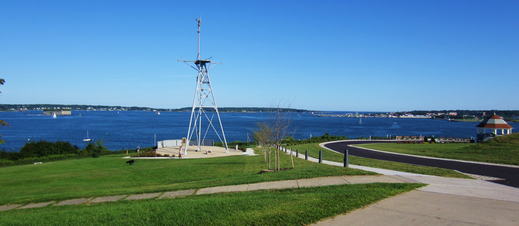
 (Photograph by Bd2media, CC BY SA-4.0)
 -
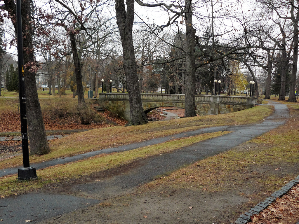
 (Photograph by John F. Bauman)
 -
 (Photograph by John F. Bauman)
 -
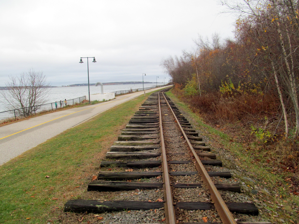
 Maine Narrow Gauge Tracks along the Eastern Promenade (Photograph by Pi.1415926535, CC BY SA-3.0)


Portland’s exquisite public park system is a product of the early-nineteenth-century movement for parks in cities across the United States and a testament to the talents of engineers and landscape architects such as William A. Goodwin and the Olmsteds, and political leaders such as Portland mayor James Phinney Baxter, who recognized the vital role of parks and greenery for the public health and well-being of urban residents.
Located on a saddle-shaped peninsula that juts into island-studded Casco Bay, the City of Portland is bounded on the southwest by Bramhall Hill and on the northeast by Munjoy Hill; the former possesses distant views of Mount Washington in New Hampshire, the latter offers panoramic views of Casco Bay with picturesque old forts and four lighthouses. To the southeast lies the navigable Fore River and the city’s port facilities, to the northwest the Back Cove, and just south of the Back Cove, Deering Woods. Between 1828 and 1925 all of these scenic landmarks became parts of Portland’s Park System.
In 1828 the City of Portland acquired twelve acres of land located on the brow of the then sparsely settled Munjoy (Mount-Joy) Hill overlooking Casco Bay, but it was not until 1837 that the city built a scenic thoroughfare called the Eastern Promenade, a 40-foot wide, tree-lined carriage way designed to take full advantage of the scenic views. Today, it encompasses 68.2 acres and is 1.5 miles in length. While construction of the Eastern Promenade was underway, the city acquired property on the western end of the peninsula for a similar carriage way and in 1878, under the guidance of city engineer Goodwin, Portland converted the Eastern Promenade and its western counterpoint into full-fledged public parks.
By 1881, Goodwin had developed a vision for a park system linking the Eastern Promenade with the Western Promenade and Deering Oaks Park (1879), a vision firmly embraced by wealthy entrepreneur, civic leader, philanthropist, and reform mayor, James Phinney Baxter (1831–1921). An apostle of the City Beautiful movement, Baxter imagined an “Emerald Necklace” of city parks matching Boston’s Olmsted-designed park system.
In 1890 the city purchased Fort Allen (c. 1775; rebuilt 1814) and created the nine-acre Fort Allen Park bordering Eastern Promenade to the south. Improvements to the entire promenade and Fort Allen Park continued through 1897 and included the addition of recreation facilities such as a baseball field and outdoor gymnasium. In 1905 Baxter hired the Olmsted firm to further develop the Eastern Promenade and to create a master plan for a cohesive park system. Their plan introduced pedestrian paths along the hillside as well as a separation of circulation systems, including a proposed pedestrian overpass at Cutter Street. The Olmsted firm divided the Eastern Promenade into four areas: a baseball field, play field, children’s playground, and a “Little Children’s Lawn.” The plan also included a monument to city founder George Cleave, to be located at the intersection of Congress and Eastern Promenade, and a concourse at the northern end of the Promenade at Washington Street and at Fort Allen Park at the eastern end. The plan was never fully realized; in place of the concourse, the city built a circle at the northern end of Washington Street that is planted with rosa ragosa and Japanese barberry.
Land acquisition continued until 1916 and the city continued improvements efforts until about 1934, including the addition of a parking area on Cutter Street. In 1963 the East End Beach was closed to swimming due to severe pollution, which resulted in the construction of a sewage treatment plant in 1979 at the base of Munjoy Hill. Then a working-class neighborhood, it is now one of Portland’s more desirable and expensive residential areas. East End Beach reopened in 1980; a bathhouse, boat ramp, and parking lot were added a decade later. A former rail corridor was converted in the late 1990s into the Eastern Promenade Trail. The Maine Narrow Gauge Railroad Company and Museum is located adjacent to the trail, south of Fort Allen, and operates a mile-and-a-half railway for scenic tours. The Friends of the Eastern Promenade, a non-profit organization, works with the City of Portland in management of the site and the implementation of the 2004 Eastern Promenade Master Plan, which aims to protect the historic assets of the park.
References
Bauman, John F. Gateway to Vacationland: The Making of Portland, Maine. Amherst: University of Massachusetts Press, 2012.
Holtwyk, Theodore H.B., and Earle G. Shettleworth, Jr., eds. Bold Vision: The Development of the Parks of Portland, Maine. Kennebunk, ME: Greater Portland Landmarks, 1999.
Portland Department of Parks and Recreation and Walker-Kluesing Design Group. Eastern Promenade Master Plan. Portland, ME: Portland Department of Parks and Recreation, 2004.