


At the corner of Forest Avenue and Bedford Street on the campus of the University of Southern Maine (USM) in Portland, the Osher Map Library and Smith Center for Cartographic Education looms as an extension of the Glickman Family Library, a seven-story, reinforced concrete structure built in 1919 as the Nabisco Bakery and renovated by USM in the 1990s. The Harold and Peggy Osher Map Library opened in 1994 and was originally housed in a 3,200-square-foot, two-floor section of Glickman Library. The cartographic collection includes rare historic maps, with the oldest being a world map dated 1475. The library’s collection rapidly expanded, and by 2003, plans were underway for a new facility that would provide additional classroom space, updated cartographic technology, improved environmental controls, and enhanced accessibility to the collections.
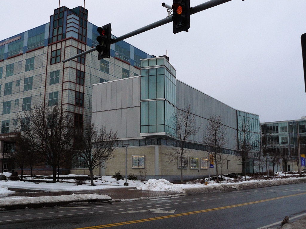
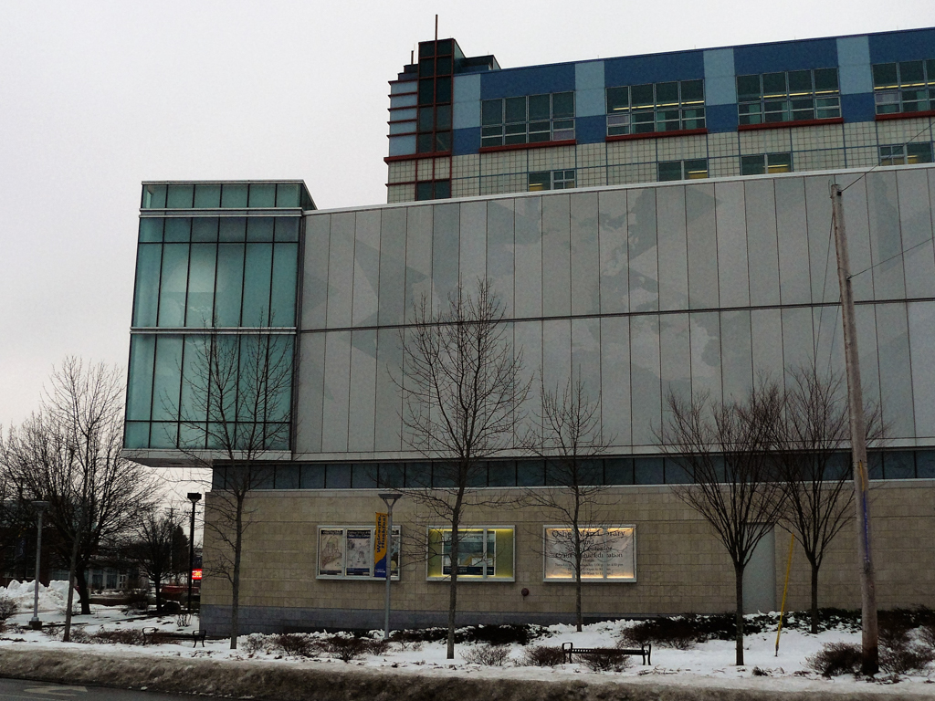
To design the 26,000-square-foot addition, USM chose the Boston architectural firm of Koetter, Kim and Associates, which had also designed the nearby Wishcamper Center. Principal architect Susie Kim produced a design that provided plentiful natural illumination in the central research room, as well as protective indirect light and environmental controls to safeguard the world-renowned collection of maps and globes. The bold glass, steel, and stone-faced facade of the three-story building, which greatly relieves the sternness of its industrial Glickman parent, not only announces the entrance to the university, but also the cartographic mission of the Osher map facility. Emblazoned across the huge flat metallic surface of the Bedford Avenue facade is subtly etched Buckminster Fuller’s Dymaxion Map (1954), a projection map that reveals the planet comprehensively. It is a bold feature that is integral to the building’s architecture.
At the western corner of the building, facing Bedford Avenue, Kim cantilevered a two-story decorative glass box at an oblique angle over the first story. It is empty space, but in large letters it advertises the name of the building. Beneath the cantilevered glass box is one of the two entrances to the building. The flat, metallic upper second and third stories of the edifice (bearing Fuller’s Dymaxion Map) overhang the stone-sheathed first story, which has a strip of glass windows just beneath the overhang. Below this upper glass strip, the first-floor Oxford Avenue facade features a window and sets of glass exhibit cases that, like the Fuller projection map, advertise the building’s contents.