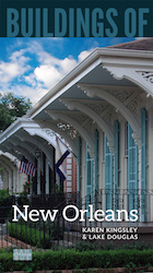
Esplanade Avenue’s closely spaced houses, tall and narrow with side halls, and often built up to their property line, give the street a distinctive and sophisticated urban character. By the 1850s, when the Vieux Carré was becoming shabby, Creoles—often free people of color—began to build houses along Esplanade Avenue. Many adopted the American town house plan: three bays wide to incorporate a side hall, a service wing to the rear, a rear or side garden, and Greek Revival embellishments, most notably around the entrance portal. Houses on the blocks from the Mississippi River to N. Rampart Street display these features best. By the early twentieth century, Esplanade Avenue was built all the way to Bayou St. John, beyond which lay City Park. Midway along Esplanade, in the 2200 block, is a small triangular park, Gayarré Place (dedicated to New Orleans historian Charles Gayarré), marking the point where Bayou Road crosses the avenue. A statue of the Goddess of History stands on a tall square pedestal of red terra-cotta decorated with arches, cherubs, and various leafy ornaments. The pedestal was originally displayed at the Cotton Centennial Exposition of 1884 in Audubon Park as a demonstration of the versatility of terra-cotta.
Esplanade’s architectural integrity was compromised by construction in 1966–1968 of the Claiborne Avenue elevated expressway (I-10), which cut across the avenue and other connecting streets, bifurcated the historic Tremé neighborhood (causing several blocks of houses to be demolished or become derelict), eliminated double rows of live oak trees, and effectively destroyed the African American commercial corridor along lower Claiborne Avenue. Efforts are now underway to study and address the expressway’s removal.
Bayou St. John is about four miles long and, since it empties into Lake Pontchartrain, was a Native American trade route. Jean-Baptiste Le Moyne, Sieur de Bienville, referred to it as the “back door” entrance to New Orleans and named it for his patron saint, John the Baptist. In the eighteenth and early nineteenth centuries the bayou was an important transportation route linking Lake Pontchartrain with the Vieux Carré, via the Carondelet Canal (1790s), and then to the Gulf of Mexico. In addition, this area was a popular site for pedestrian activities (the “Carondelet Walk”) and nineteenth-century pleasure gardens (commercial amusement parks on private property). Today, the bayou is a placid waterway picturesquely lined with houses on both banks, leading toward City Park.
Writing Credits
If SAH Archipedia has been useful to you, please consider supporting it.
SAH Archipedia tells the story of the United States through its buildings, landscapes, and cities. This freely available resource empowers the public with authoritative knowledge that deepens their understanding and appreciation of the built environment. But the Society of Architectural Historians, which created SAH Archipedia with University of Virginia Press, needs your support to maintain the high-caliber research, writing, photography, cartography, editing, design, and programming that make SAH Archipedia a trusted online resource available to all who value the history of place, heritage tourism, and learning.

